Showing posts with label Caribbean. Show all posts
Richard Bangs: The Cayman Islands - Fifty Shades of Bay (Part 4)
I hope you have enjoyed the series and I want to thank Richard for sharing with us.
The Cayman Islands: Fifty Shades of Bay
By Richard Bangs
It’s the final afternoon in paradise, and I head for Hell.
Hell, it turns out, is a flash in the road near West Bay, named for a swatch of spiky, tortured, black, ironshore that looks like midday in the garden of evil. There are just a few structures in Hell: a bar named Club Infernal; the Devil’s Den novelty shop, a post office where one can send a postcard from Hell; and the fire-red barn called The Devil’s Hangout, sporting Beelzebub on the side, and the devil on a sheet of plywood in front with a circular hole where the face should be.
After I park on the brimstone pavement, a man wearing a red cape, pointed horns, a sharply trimmed goatee, and carrying a three-pronged pitchfork, bounds over with an arsenal of greetings:
"How the hell are you?" “Hell of a nice day.” and "Where the hell you from?"
“From Los Angeles, City of Angels. How do you like living here?” I ask.
“It’s a hell of a place.”
“How’s the weather?”
“Hot as Hell. But living Hell is the best revenge”
“Who the hell are you?”
Turns out Satan is septuagenarian Ivan Farrington, who makes a living dishing out every hellish pun on earth. He bought the shop in 1987 when it was called, like so many other affairs in these islands, “Paradise.” But, he says, “My business went straight to Hell, so I renamed it the Devil’s Hangout.” Now he does brisk commerce selling satanic souvenirs-- t-shirts with slogans such as “I took your advice and came here in a hand basket,” as well as coffee mugs, spoons, bumper stickers, whelk shells, and postcards with every mal mot conceivable.
As I pay for a bottle of Scotch bonnet-based Hell sauce Ivan pulls out his calculator and says, "I was born on July 17, 1934." He taps the numbers '17, 7, and 34' into the calculator, turns it upside-down. It reads: "HELL!"
When he hands me change he snorts, "Thank you. Now get the hell out of here.” As I depart, I realize I’m made a wrong turn, ending up on Church road. So, I make the U-Turn, and once again pass through Ivan’s infernal town, so at least I can say, with all honesty, I’ve been to Hell and back.
So, what makes the Cayman Islands different? My undergraduate degree is in Sociology from Northwestern University, and I still pal around with sociologists, and some fret about constant e-mailers and texters losing the everyday connections to casual acquaintances or inconnus who may be sitting a touch away in the café or on the bus. That is the current dynamic in the continental U.S., in Europe, Asia and beyond; but not yet here. It could be said that we in the US are now, more than ever before, building barricades with our devices, employing screens that screen out strangers. Yes, they reinforce family and friends—we can chat and text and twitter with them more than ever—yet we are blocking the chance encounters, the random meetings, and with them the brushes against novel and unfamiliar perspectives, and the shivery flashes of insights. Cayman is different, and it disarms all who visit.
The Caymans Islands achieves a kind of correspondence between belief and place, between inner and outer landscapes, between travelers and locals, as all trace to somewhere else.
Caymanians talk to everyone. They look up at the clear sky. There is a dance to their tread. Adults become children as they swim with stingrays. Businesspeople walk to their appointments, greeting the people they see. Caymanians are connected to the sky and water and land, and, most of all, connected to one another, and to those who visit.
Wandering through the blades of sunlight along the paths of Cayman, witnessing the mastery of environmentalists and entrepreneurs, delving into the music, food, nature and culture, and basking in the welcomes of new acquaintances, I am knocked over with a feeling of being part of something deeply human and universal.
The paradox of the Cayman Islands is that it was a bleak, unwelcoming place that kept people away for much of its history; yet it became a place of gathering for modern questers, and as such, a locus for the exchange of fresh ideas, of fusions of food, song and the arts. It was once considered a Hell on earth, but it became Paradise. And it is today a milieu that transports identity and tolerance, romance and preservation; it unnerves habits and perceptions, unwinds the mind, sheds shells, and along the way leads to the loss of items not usually missed….pins and needles, taxing thoughts, and disquietude.
This is the treasure of the Cayman Islands.
Richard Bangs: The Cayman Islands - Fifty Shades of Bay (Part 3)
The Cayman Islands: Fifty Shades of Bay
By Richard Bangs
Part 3 of 4 Parts
Cayman Islands
The hours melt away as I snorkel the brilliant reefs, hike the filigreed interior, draw figures in the sand, collect lovely shells, even paddle around the island in a leaky plastic kayak. I finish reading my one book, Explorers of the Nile, and then stare at a palm tree. I come to admit I’m bored. All these studies about how continued connectedness leads to attention deficit disorder may be true. I’m restless, and anxious. I need a fix. It’s time to get back to civilization. So, I pull out my cell, and push the on-button. But nada. It’s out of juice. I panic. But then reach deeper into my pack, pull out an Energizer portable charger, plug it into the phone, and make the call. But it goes to a robot voice saying the mailbox is full; call again later. I’m castaway on a desert island.
So, I decide to swim for it. I stash my pack and sandals, towel, hat and sunglasses, and head into shark and jellyfish waters towards the shore of Little Cayman.
I make it, and after arranging for a pick-up of my left-behind gear and electronics, head to the Edward Bodden Airfield, and catch the first flight back to Grand Cayman, and then straight to Camana Bay, the new cosmopolitan development packed with so many high-end restaurants, glam shops and luxury labels some call it Brand Cayman.
I first stop at Books & Books, carrying the kind of collections the best Borders used to offer, and pick up several new titles, in case I’m stranded on a desert island again, or a hurricane hits. I step by the sports stadium, where the Rugby team “No Woman No Try” is practicing. I stop for a delightful meal at Ortanique, a Nuevo Latina Carib-Asian eatery. And I run into Kenneth Hydes, the VP of Product and Experiences, who tells me the billion dollar development is the brain child of Kenneth Dart, heir to the Dart Container Corporation of Michigan, world's largest manufacturer of foam cups. Kenneth gave up US Citizenship in 1994, moved to Cayman, becoming an investor, and a champion of recycling initiatives. His refined taste is represented in Camana Bay, which is more Rodeo Boulevard than Caribbean sugar shack, more Waterford and Cartier than watermelon and giclée, and it gives Cayman, already the most sophisticated stop in the region, an extra lift.
The perfumed tropic air is Sunday’s, and at the crack of noon I head out for the contrast to Camana Bay, the Grape Tree Café on the beach in Bodden Town with its locally-famous Sunday Fish Fry. This is where the islanders come, and bask in deep-fried bliss. “It humbles the stomach,” says Alex Bodden, related to the first settler on Cayman back in 1700, and who owns, with his family, the adjacent Texaco gas station and liquor store. The perfect combination platter. The café itself is the size of breadfruit basket, and sizzling away inside are chunks of snapper, mahi, wahoo, swai, chicharrón, as well as conch fritters, plantains, cassava, and sweet potatoes, all for a fraction the price of the fusion appetizers at the resort hotels and trendier west end eateries. And outside, around thatch-roofed tables, an array of well-nourished Caymanians sit and nosh, swap stories and jokes, and generally enjoy the island life and food.
After lunch I’m hungering for some island music, so head over to Hopscotch Studios, where the Swanky Kitchen Band is in full practice mode for an upcoming wedding performance.
It’s an incredibly energized jam—it’s music that softens rock, and could bend the ironwood tree. Between takes I chat with the electric violinist Samuel Rose, the leader. He explains that “swanky” is a Cayman word for lemonade (made with brown cane sugar), and that Cayman kitchen music represents the melting pot that is Cayman, tracing influences back to Irish fiddling and Scottish jig traditions, mixed with African slave rhythms. Then it blends in ostinatos of calypso, reggae and jazz.
“In the old days the kitchen, or caboose as we call it, was the center of Caymanian homes, a detached room in the back where everyone gathered, and so it became a natural place to socialize, celebrate, dance and create music, using cassava graters and other kitchen utensils. We’ve picked up on that tradition, and are carrying it forward with our own signature.” But Samuel doesn’t want to jab too long; he wants to skank, and I’m not suffering from an overabundance of good sensations, so I step to the back of the room, pick up my feet in terpsichorean splendor, and surrender to the swank.
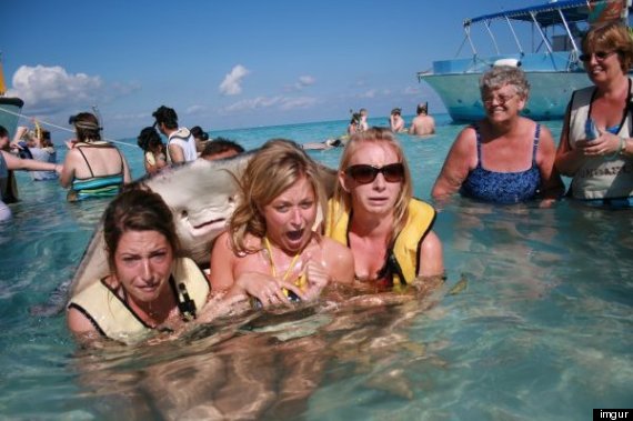
So, this final soft-blue morning I catch a fishing boat named Heavenly Hooker and head out to find the scene of the slime. We cruise out to a shallow bank in the North Sound, drop anchor, and beneath crystalline waters see a dozen gray-hued underwater bats, the size of pterodactyls, gracefully circulating at our stern. Captain Stacy leaps into the waist-deep brine with a bucket of smelly squid. Immediately the rays lap him, coddle him; cats to catnip. The captain motions me to join, but I’m a bit hesitant, remembering too well Steve Irwin’s untimely death by stingray barb in the Great Barrier Reef.
But what good is travel without a little fear? So, I take the leap, and though my mind is trembling on the edge of danger, the soft Portobello mushroom skin of the rays against my own is rather silky and sensuous. It is an agreeable kind of horror.
This interspecies dynamic came about some years ago when fishermen, to avoid the once mosquito infested coastlines (so bad it was, they say, the mosquitos could suck a cow to bloodless death), started cleaning their catch in this calm off-shore channel, and the Atlantic Southern stingrays gathered to nibble at the gut scraps. Soon the stingrays began to associate the sound of a boat motor with food. Now, it’s a daily ritual, and the wild rays have gone gentle, gliding about torsos, through splayed legs, planting hickies on exposed human skin while suckling for food, and wrapping wings around their guests in puppy-like hugs, all in symbiotic exchange for morsels of sea meat. “Oh, it feels good to be touched by a stingray,” beams Captain Stacey. It is undeniably, ahem, a raydiant experience.
Richard Bangs: The Cayman Islands - Fifty Shades of Bay (Part 2)
Today we have part two of the guest contribution from Richard Bangs, the host of the television show Adventures with a Purpose. Richard continues his exploration of the Cayman Islands, a Caribbean paradise that offers a little something for every kind of traveler. Enjoy!
The Cayman Islands: Fifty Shades of Bay
By Richard Bangs
Part 2 of 4 Parts
From here I wind back to the western side of the island, to Lighthouse Point, to meet Nancy Easterbrook, the fire behind a critical ecological initiative in the Caribbean: Eat a fish; Save the fish.
Nancy, who is managing partner of Divetech, says in recent years the beautiful Indo-Pacific lionfish, studded with toxin-tipped spines, has found its way to the Caribbean, and is not only rapidly pro-creating (one female can produce 2 million eggs a year), but vigorously reducing the populations of native fish, insatiably gobbling up juveniles and hurting the reef habitat. It is an abundance that produces scarcity. Besides the threat of species elimination, there is a looming fiscal threat as well. Since diving the clear waters of the Cayman Islands, so vivid with their extraordinary array of marine life, is a key tourism draw, the loss of native tropical fish could send divers elsewhere, an economically devastating scenario.
How did this scourge get here? Some guess from ballast water released by freighters after passing through the Panama Canal; others believe from home aquariums in Florida, perhaps emptied during a hurricane. However they got here, they’re multiplying and devouring like zombies.
Throughout the world overfishing is a critical issue. But not here, at least when it comes to lionfish. In response to the invasion the Department of Environment offers culling courses and licenses special slings to capture and kill lionfish. Several dive companies set aside a day a week for hunting lionfish. And restaurants are buying the fish
Nassau groupers have the big mouths needed to devour lionfish. They routinely follow divers and consume lionfish speared by divers. If the grouper can learn to attack and consume lionfish without the aid of divers, then natural controls will take effect. After all, in the western Pacific and Indian Ocean lionfish populations are maintained at equilibrium by local predators, such as large groupers and reef sharks.
Nancy hands me a flier called “Cayman Sea Sense,” which outlines restaurants that are certified ocean friendly, and says I should boycott eateries that serve grouper, and instead look for places offering up lionfish, such as The Greenhouse, a new café in the neighborhood. The cook and co-owner, Jennifer Skrinska, fries up, in coconut oil, some lightly-floured lionfish, a flash in the pan we hope not…and concocts a lionfish ceviche served with homemade flatbread, which, though small in portions, is terribly tasty….and, if enough folks eat lionfish, encouraging more fishermen to clip the weed fish of the Caribbean, then the other, native fish will remain in healthy numbers. So, eat a fish, save the fish.
After lunch I catch a Cayman Airways Express Twin Otter to Cayman Brac, 90 miles to the northeast. At 12-miles long and a mile wide, it is the second largest of the trine that make up the the Cayman Islands. I check into the Alexander Hotel, have a cold Caybrew at the bar, and head out to explore with local guide Keino Daley.
There are no inclusive resorts in Cayman Brac; no casinos; golf courses; little in the way of shopping, and just a few restaurants. But it has birds, trails, cliffs, reefs, and caves. Brac and its sister island, Little Cayman, move to the rhythms of the natural world, relics of what the Caribbean used to be.
As we slope uphill Keino says the island is named for the limestone bluff, or Brac in Scottish Gaelic, that looms at its peak at 141 feet above the sea, where sits a solar-powered lighthouse, highest structure throughout the islands.
Then we climb down a cliff overlooking Spot Bay, Keino’s hometown, and crawl into Peter's Cave, one of 170 littoral caves on the island. Rumors persist this, and other grottoes, were used as lairs by pirates, even perhaps Captain Morgan and Blackbeard, using the dark recesses to hide their booty.
I was an active spelunker in college, and back then used a carbide lamp attached to a helmet to negotiate the stygian passages. Other times throughout the years I’ve used flashlights, headlamps, even candles and torches. But none of these illuminating accessories are with me now, so instead I tap the flashlight app on my iPhone (which is in turn attached to an Energizer charger so as not to lose juice while deep in some defile), and the dark world is alight.
Though not a deep cave, Peter’s has its share of fairy tale beauty and spelean riches. The flowstones look like melting cake icing; the cave coral like popcorn; the draperies like strips of bacon; and the Aragonite crystals like frostwork, or frozen flowers. Though no treasure be found, the long-winged bat of imagination soars here.
Back at the Alexander Hotel the manager Karen Gascoigne wants to show off her latest toy, a two-seater Wheego LiFe, the first electric car on the island, and the first offered to hotel guests in the Caribbean, she says. As we tool to a vanilla-hued beach for sundown she says the car can travel about 100 miles on a single charge (more distance than all Brac roads combined), and can reach 80 miles per hour, though she has yet to test that claim.
Karen says it is the right kind of vehicle for an eco-destination such as Brac. And it is quiet, to match the mood of the place.
Not so that night. It’s Friday, but crawling around caves is exhausting, and so after a rum cocktail and some jerk chicken at the Captain’s Table, and I take to bed early. But down by the bar it’s Cowboy karaoke open mic, and even with earplugs, the party seems to be at the end of my bed. When I was president of Outward Bound I realized, after reading countless accounts of sunsets and rainbows in the journals submitted by participants, that the organization might just be responsible for more bad poetry than any other on earth. And about 2:00 this morning I realize that the Alexander Hotel could be responsible for more bad singing than any other, at least in the Caribbean.
A blue dawn at last swallows the ink of night. I take the twin otter on a 10-minute hop to Little Cayman, the smallest of the archipelago, shaped like a 10-mile-long coral cigar. Only about 160 folks live here year round, so it’s more like a family picnic than a municipality. Nobody locks their homes, and they keep the keys in their cars.
The first sign upon walking into the closet-sized airport: “Terminal A, Gate 1,” painted by the chortling baggage boy. The next sign is on the road, “Iguanas have the right of way.” There are more iguanas than people here. More hermit crabs on the roads than people. More of almost any living native creature than people. This elongated spit hosts the largest bird sanctuary in the Caribbean, full of red-footed boobies, whistling ducks and frigates. Electricity didn't make it here until 1990, and phone service until 1991. This is my kind of place.
I’ve decided to come here for a digital detox; to surrender to a sanctuary unplugged. But even Little Cayman seems too crowded and connected. There is even Wi-Fi.
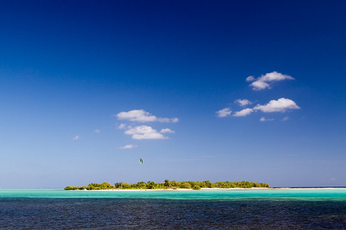
So, I hire a little outboard boat to take me to Owen Island, a true desert island off the southern coast of Little Cayman. The isle has no lights; no electricity; no man-made structures; no men or women. Just talcum-soft white sand, driftwood, scrub and a lagoon.
But as the little boat is pulling away after dropping me off I yell to Jeremy, the driver, “When will you come back to pick me up?”
“Call me when you’re ready,” he shouts over the din.
“But I’m on a digital detox.” I protest as he disappears over the blue waves. I dig into my pack, exhume my buried cell phone, and turn it on, against the self-imposed rules. There is, to my amazement, a signal. But the battery is low, so I turn the phone off and entomb it again.
The Cayman Islands: Fifty Shades of Bay
By Richard Bangs
From here I wind back to the western side of the island, to Lighthouse Point, to meet Nancy Easterbrook, the fire behind a critical ecological initiative in the Caribbean: Eat a fish; Save the fish.
Nancy, who is managing partner of Divetech, says in recent years the beautiful Indo-Pacific lionfish, studded with toxin-tipped spines, has found its way to the Caribbean, and is not only rapidly pro-creating (one female can produce 2 million eggs a year), but vigorously reducing the populations of native fish, insatiably gobbling up juveniles and hurting the reef habitat. It is an abundance that produces scarcity. Besides the threat of species elimination, there is a looming fiscal threat as well. Since diving the clear waters of the Cayman Islands, so vivid with their extraordinary array of marine life, is a key tourism draw, the loss of native tropical fish could send divers elsewhere, an economically devastating scenario.
How did this scourge get here? Some guess from ballast water released by freighters after passing through the Panama Canal; others believe from home aquariums in Florida, perhaps emptied during a hurricane. However they got here, they’re multiplying and devouring like zombies.
Throughout the world overfishing is a critical issue. But not here, at least when it comes to lionfish. In response to the invasion the Department of Environment offers culling courses and licenses special slings to capture and kill lionfish. Several dive companies set aside a day a week for hunting lionfish. And restaurants are buying the fish
Nassau groupers have the big mouths needed to devour lionfish. They routinely follow divers and consume lionfish speared by divers. If the grouper can learn to attack and consume lionfish without the aid of divers, then natural controls will take effect. After all, in the western Pacific and Indian Ocean lionfish populations are maintained at equilibrium by local predators, such as large groupers and reef sharks.
Nancy hands me a flier called “Cayman Sea Sense,” which outlines restaurants that are certified ocean friendly, and says I should boycott eateries that serve grouper, and instead look for places offering up lionfish, such as The Greenhouse, a new café in the neighborhood. The cook and co-owner, Jennifer Skrinska, fries up, in coconut oil, some lightly-floured lionfish, a flash in the pan we hope not…and concocts a lionfish ceviche served with homemade flatbread, which, though small in portions, is terribly tasty….and, if enough folks eat lionfish, encouraging more fishermen to clip the weed fish of the Caribbean, then the other, native fish will remain in healthy numbers. So, eat a fish, save the fish.
After lunch I catch a Cayman Airways Express Twin Otter to Cayman Brac, 90 miles to the northeast. At 12-miles long and a mile wide, it is the second largest of the trine that make up the the Cayman Islands. I check into the Alexander Hotel, have a cold Caybrew at the bar, and head out to explore with local guide Keino Daley.
There are no inclusive resorts in Cayman Brac; no casinos; golf courses; little in the way of shopping, and just a few restaurants. But it has birds, trails, cliffs, reefs, and caves. Brac and its sister island, Little Cayman, move to the rhythms of the natural world, relics of what the Caribbean used to be.
As we slope uphill Keino says the island is named for the limestone bluff, or Brac in Scottish Gaelic, that looms at its peak at 141 feet above the sea, where sits a solar-powered lighthouse, highest structure throughout the islands.
Then we climb down a cliff overlooking Spot Bay, Keino’s hometown, and crawl into Peter's Cave, one of 170 littoral caves on the island. Rumors persist this, and other grottoes, were used as lairs by pirates, even perhaps Captain Morgan and Blackbeard, using the dark recesses to hide their booty.
I was an active spelunker in college, and back then used a carbide lamp attached to a helmet to negotiate the stygian passages. Other times throughout the years I’ve used flashlights, headlamps, even candles and torches. But none of these illuminating accessories are with me now, so instead I tap the flashlight app on my iPhone (which is in turn attached to an Energizer charger so as not to lose juice while deep in some defile), and the dark world is alight.
Though not a deep cave, Peter’s has its share of fairy tale beauty and spelean riches. The flowstones look like melting cake icing; the cave coral like popcorn; the draperies like strips of bacon; and the Aragonite crystals like frostwork, or frozen flowers. Though no treasure be found, the long-winged bat of imagination soars here.
Back at the Alexander Hotel the manager Karen Gascoigne wants to show off her latest toy, a two-seater Wheego LiFe, the first electric car on the island, and the first offered to hotel guests in the Caribbean, she says. As we tool to a vanilla-hued beach for sundown she says the car can travel about 100 miles on a single charge (more distance than all Brac roads combined), and can reach 80 miles per hour, though she has yet to test that claim.
Karen says it is the right kind of vehicle for an eco-destination such as Brac. And it is quiet, to match the mood of the place.
Not so that night. It’s Friday, but crawling around caves is exhausting, and so after a rum cocktail and some jerk chicken at the Captain’s Table, and I take to bed early. But down by the bar it’s Cowboy karaoke open mic, and even with earplugs, the party seems to be at the end of my bed. When I was president of Outward Bound I realized, after reading countless accounts of sunsets and rainbows in the journals submitted by participants, that the organization might just be responsible for more bad poetry than any other on earth. And about 2:00 this morning I realize that the Alexander Hotel could be responsible for more bad singing than any other, at least in the Caribbean.
A blue dawn at last swallows the ink of night. I take the twin otter on a 10-minute hop to Little Cayman, the smallest of the archipelago, shaped like a 10-mile-long coral cigar. Only about 160 folks live here year round, so it’s more like a family picnic than a municipality. Nobody locks their homes, and they keep the keys in their cars.
The first sign upon walking into the closet-sized airport: “Terminal A, Gate 1,” painted by the chortling baggage boy. The next sign is on the road, “Iguanas have the right of way.” There are more iguanas than people here. More hermit crabs on the roads than people. More of almost any living native creature than people. This elongated spit hosts the largest bird sanctuary in the Caribbean, full of red-footed boobies, whistling ducks and frigates. Electricity didn't make it here until 1990, and phone service until 1991. This is my kind of place.
I’ve decided to come here for a digital detox; to surrender to a sanctuary unplugged. But even Little Cayman seems too crowded and connected. There is even Wi-Fi.
So, I hire a little outboard boat to take me to Owen Island, a true desert island off the southern coast of Little Cayman. The isle has no lights; no electricity; no man-made structures; no men or women. Just talcum-soft white sand, driftwood, scrub and a lagoon.
But as the little boat is pulling away after dropping me off I yell to Jeremy, the driver, “When will you come back to pick me up?”
“Call me when you’re ready,” he shouts over the din.
“But I’m on a digital detox.” I protest as he disappears over the blue waves. I dig into my pack, exhume my buried cell phone, and turn it on, against the self-imposed rules. There is, to my amazement, a signal. But the battery is low, so I turn the phone off and entomb it again.
Richard Bangs: The Cayman Islands - Fifty Shades of Bay (Part 1)
As for Richard, he has an extensive background in exploration, including making first descents of more than 35 rivers across the globe. He is also one of the founder to Sobek Expeditions, one of the top adventure travel companies in the world. Bangs has spent over 40 years of his life exploring remote areas of the planet, and I'm honored that he wanted to share one of his more recent stories with us here on my blog.
This article is the first of four parts, that focuses on the Cayman Islands and the numerous opportunities for adventure that exist in that Caribbean paradise. I hope you enjoy this series as much as I did, and again, big thanks to Richard for sharing with us.
The Cayman Islands: Fifty Shades of Bay
By Richard Bangs
Part 1 of 4 Parts
Over the years I’ve caressed many of the Caribbean gems, but never a set like the Cayman Islands. An accident of geography and geology, the three coral islands, cursed with terrible soil, minimal terrestrial relief, no rivers or lakes, but a bask of crocodiles, was not settled by the Caribs, Arawaks, Tainos, or any other autochthons, by the time Christopher Columbus sailed by in 1503. The sharp, black dolomite outcroppings in some places evoked Hades rather than any sort of haven. The first recorded English visitor was Sir Francis Drake in 1586, who reported that the crocs, or caymanas, were edible, as well as the many turtles, but that note didn’t persuade immigration until around 1700, when the first recorded permanent inhabitant of the Cayman Islands, Isaac Bodden, of Welsh descent, was born on Grand Cayman. After him came pirates, refugees from the Spanish Inquisition, shipwrecked sailors, and slaves, but not many as the barren land couldn’t really support plantations or communities of consequence, as nearby Jamaica and Cuba could.
So, it grew up a place with few people. Instead the world came to Cayman, into its coves, sounds, channels, runs and bays. And that diversity of settlers may have saved it from the worn-out, overtaxed fate other islands have suffered. It became a place where everyone was from somewhere else—over 100 different nationalities are represented today--- and that ripened into an ethos that invites strangers into the conversation.
The Caymans Islands float at a magical inflection point influenced by three continents, and a radiance of nearby islands. Buccaneers prowled about in search of provisions, safe harbors, and remote spots to bury doubloons. The anchored ships were in a way like bees pollinating flowers in gardens far from where they started, spreading ideas, arts and cultures over this trinity of islands. They brought different music, dance, foods, customs, crafts, beliefs, and new human constructs….the travelers and adventures found shelter and social interaction, and the seeds of multiculturalism were sown.
I take the Bird of Paradise, Cayman Airways, from Miami, a Boeing 737-300, and am delighted to find the carrier allows two free checked bags, the exception these days. It is also the only carrier I’ve ever flown that offers rum punch on the service tray. Turns out the punch is supplied by the Tortuga Rum Cake factory, started by a former pilot, Robert Hamaty, whose son, Basil, is our captain.
In 1966 legislation passed enabling the banking industry in the Cayman Islands, and that changed everything. The British Overseas Territory went from a sleepy backwater with scarce resources to the fifth-largest banking center in the world with trillions on deposit. Today it has branches of 40 of the world's 50 largest banks. One five-story building in the capital George Town, The Ugland House, no bigger than a boutique hotel, houses over 18,000 corporations. Business and financial services contribute 30% of the GDP, and employ more than 20% of the labor force. The Cayman Islands has the highest per capital income in the Caribbean, no taxes, and almost no unemployment. And it has evolved into a matchlessly clean, pristine and pleasing destination for travelers.
At the northern end of Seven-Mile Beach (it clocks in at five miles and a few minutes long, but that’s the nature of Cayman….everything is a little bigger than reality), I check into the hotel and take a room where I can see the powdery sweep of sand, the tufted tops of palms soughing in the breeze, and the tourmaline waters that will somewhere to the west brush the shores of Central America.
The tumbling sun bathes the remnants of the day in gold, the norm here I’m told, and radiates romance. Barefoot couples stroll the seam between sand and water, hand-in-hand, while others sip champagne on lounge chairs as the tropic air seduces. By the reckonings of a number of sand experts, this is the most romantic beach in the Caribbean. It’s as close to living brochureware, or a set for a diamond commercial, as I’ve seen in real life. Later I chat with Joanne Brown, CEO & Creative Director of a company called Celebrations, a wedding planning company, and she says business is booming. Many folks come here, she says, and are bewitched by the beaches, the diving, the sunsets, the food and wine, and decide to return to tie the knot.
As we pull to the gate at Owen Roberts Airport there is a giant green iguana on the tarmac. No ordinary airport, this. No ordinary airline. There have been dozens of airlines in the Caribbean that launched and then fell into the ocean of bankruptcies. But Cayman Airways has been around since 1968, and now serves half a dozen cities in the U.S., as well as Cuba, Jamaica, Panama and Honduras.
On the taxi ride to the Westin Casuarina, the driver, almost to the point of overprize, crows about how safe Cayman is…. “You can walk anywhere, anytime, mon. The beaches have no litter, no vendors, no hassles, no homeless, just pure sugar sand.” I live in Venice Beach, near the Google offices, and despite the home prices and wealth, there is a large indigent population, and a crime rate not to be envied. How do they do it here? In 1966 legislation passed enabling the banking industry in the Cayman Islands, and that changed everything. The British Overseas Territory went from a sleepy backwater with scarce resources to the fifth-largest banking center in the world with trillions on deposit. Today it has branches of 40 of the world's 50 largest banks. One five-story building in the capital George Town, The Ugland House, no bigger than a boutique hotel, houses over 18,000 corporations. Business and financial services contribute 30% of the GDP, and employ more than 20% of the labor force. The Cayman Islands has the highest per capital income in the Caribbean, no taxes, and almost no unemployment. And it has evolved into a matchlessly clean, pristine and pleasing destination for travelers.
At the northern end of Seven-Mile Beach (it clocks in at five miles and a few minutes long, but that’s the nature of Cayman….everything is a little bigger than reality), I check into the hotel and take a room where I can see the powdery sweep of sand, the tufted tops of palms soughing in the breeze, and the tourmaline waters that will somewhere to the west brush the shores of Central America.
The tumbling sun bathes the remnants of the day in gold, the norm here I’m told, and radiates romance. Barefoot couples stroll the seam between sand and water, hand-in-hand, while others sip champagne on lounge chairs as the tropic air seduces. By the reckonings of a number of sand experts, this is the most romantic beach in the Caribbean. It’s as close to living brochureware, or a set for a diamond commercial, as I’ve seen in real life. Later I chat with Joanne Brown, CEO & Creative Director of a company called Celebrations, a wedding planning company, and she says business is booming. Many folks come here, she says, and are bewitched by the beaches, the diving, the sunsets, the food and wine, and decide to return to tie the knot.
Just a decade ago, the Grand Cayman blue iguana teetered on the cliff of oblivion, with only 10 to 25 left in the wild, all on this one island. Unaccustomed to predation, it fell victim to an invasion of stray dogs, feral cats and rats. Many ended up as road kill as they sunbathed on increasingly busy streets.
But as of my visit the turquoise-colored reptile has returned to promising numbers, and is no longer listed as a critically endangered species. It dodged the bullet of extinction.
With a switchblade strut that telegraphs sense of purpose, John Marotta, head warden of the Blue Iguana Recovery Program, shows me around the captive breeding facility. He says the blue iguana now has a population of about 750, and is on the path to achieving the goal of restoring 1,000 blue iguanas to Grand Cayman's shrub lands. “If I’m successful, I’ll work myself out of a job,” John volunteers. “And I’m happy with that.”
The blue iguana is the largest native species on Grand Cayman, up to five feet in length and weighing in at more than 25 pounds (the native crocodiles were bigger, but they are all gone.) The Blue Iguana once ranged over most of the island's coastal areas and interior dry lands, but without anyone paying attention, they almost vanished.
Blue Iguanas are beautiful, with a pimpy fashion sense, but they also have that red-eyed Godzilla look that evokes menace, and they are in fact dangerous. John has 37 stitches from various bites over the seven years he’s worked to help the coldblooded critters, as well as a dislocated thumb. But one friendly fella, Methuselah, 27-years-young, lets John hold and pet him, and even allows me to rub his spikes and scratch the back of his head. John says the charismatic nature of the blue iguanas has helped raise the monies needed to bring them back, but also has helped habitat protection, as the unglamorous scrubland that few value, but which is important from an ecological standpoint, is now being set aside and protected.
John explains the program helps give juvenile iguanas a head start by protecting them for their first two vulnerable years of life, when they are still small enough to be easy snack food. Then, with radio monitors attached, they are released into the wild. After an hour of barely containing his feral enthusiasm for saving the blue iguanas, John excuses himself, as a school group is approaching, and he wants to direct energies to them. A dozen years ago I did a stint as president of Outward Bound, and one initiative under my watch was “expeditionary learning,” in which students participate in outdoor, hands-on education, rather than from books or lectures. “This is the way to get them involved in life-long conservation,” John echoes, and bolts off to his outdoor classroom, where the future is being written with lightning.
Big Word Of Thanks To My Friends At Cayman Jack
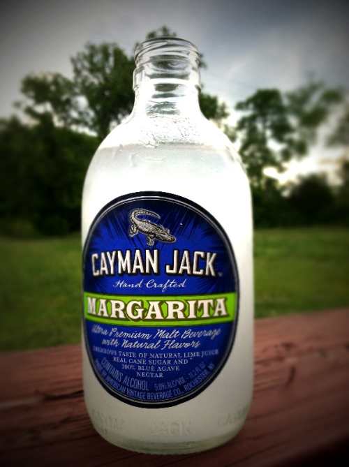
I wanted to start the week off by sending a big tip of the hat and word of thanks to my friends at Cayman Jack, the makers of a refreshing alcoholic beverage that I was introduced to recently when they sent me some samples along with a unique, one of kind, adventurers pack. For those who haven't tried it yet, Cayman Jack is a ready to drink margarita in bottle. Now, I'll be the first one to admit that I'm not much of a drinker, but I've been really enjoying the samples, particularly over some crushed ice. Better yet, I've introduced the drink to friends over the recent holiday and it was a big hit with them too.
Cayman Jack is marketed as a drink for adventurers, particularly those looking for a Caribbean escape. That was underscored with the fun "culture pack" that they sent my way with the samples bottles. That pack included a canvas bag that looks like something Indiana Jones would carry with him while raiding tombs... er ... I mean acquiring lost antiquities. Inside that pack I was delighted to discover four small metal shot glasses that are perfect for sharing the drink with friends, as well as a Swiss army knife and a simple digital camera. Perhaps best of all however, were the included cufflinks that also happen to be tiny compasses. I'll be putting those to good use I'm sure, as they'll come in handy in finding my way home from future adventures that also happen to enforce a dress code.
With the holidays just around the corner, Cayman Jack will make a great addition to your festivities, what ever they may be. If you're a fan of margaritas, but don't always have the time or energy to make them by hand, you're sure to love being able to simply pop open the top and enjoy. Unfortunately it isn't available everywhere just yet, so to find where you can purchase it near you, use this webpage. In my case, there doesn't appear to be a store that sells it close by, so when my limited supply runs out, I'm not going to be a happy adventurer at all.
Cayman Jack is marketed as a drink for adventurers, particularly those looking for a Caribbean escape. That was underscored with the fun "culture pack" that they sent my way with the samples bottles. That pack included a canvas bag that looks like something Indiana Jones would carry with him while raiding tombs... er ... I mean acquiring lost antiquities. Inside that pack I was delighted to discover four small metal shot glasses that are perfect for sharing the drink with friends, as well as a Swiss army knife and a simple digital camera. Perhaps best of all however, were the included cufflinks that also happen to be tiny compasses. I'll be putting those to good use I'm sure, as they'll come in handy in finding my way home from future adventures that also happen to enforce a dress code.
With the holidays just around the corner, Cayman Jack will make a great addition to your festivities, what ever they may be. If you're a fan of margaritas, but don't always have the time or energy to make them by hand, you're sure to love being able to simply pop open the top and enjoy. Unfortunately it isn't available everywhere just yet, so to find where you can purchase it near you, use this webpage. In my case, there doesn't appear to be a store that sells it close by, so when my limited supply runs out, I'm not going to be a happy adventurer at all.
Cuba. A voyage to Cuba, Caribbean - Havana, Santiago de Cuba...
Defying all logic, the world’s 105th-largest country is also one of its most instantly recognizable. Think psychedelic Che Guevara murals and antediluvian American Buicks, dudes with bongos and old men slapping down dominoes, queues outside ration shops and communist cadres smoking chunky Montecristos. Cuba has a way of going against the grain. It’s all part of its historical make-up, part of its dynamism, part of its intrinsic beauty.
Travel here not only requires a passport, money and a good sturdy rucksack; it also requires flexibility, creativity, good humor, patience and a healthy sense of adventure. Speaking Spanish, though not a prerequisite, is undoubtedly a huge advantage, and will allow you to travel further and dig deeper than the average tourist.Jamaica. A voyage to Jamaica, Caribbean - Kingston, Port Antonio, Blue Mountains...
Travel Alert: While the government-declared state of emergency in some parts of Kingston due to civil unrest has now been lifted, violent crime is still an issue so caution is advised when travelling. For further information see Safe Travel for updated government warnings and the BBC for the latest news updates.
Despite its location almost smack in the center of the Caribbean Sea, the island of Jamaica doesn’t blend in easily with the rest of the Caribbean archipelago. To be sure, it boasts the same addictive sun rays, sugary sands and pampered resort-life as most of the other islands, but it is also set apart historically and culturally.
US Virgin Islands Country
Introduction
Despite tourists modelling cruise wear, these shimmering islands are paradise. If people are going to persist with an American dream, they may as well wake up to some of this. Though the US flag and Postal trucks prevail, the commonalities pretty much stop there. The laid-back vibe and some of the most magnificent coast on earth provide a taste of paradise and a bit of light relief to millions each year.
Destination Facts
Capital: Charlotte Amalie
Governor: John de Jongh
President: Barack Obama
Government: unincorporated territory of the US
Time zone: GMT -3
Area: 135
Population: 119827
Languages: Baptist (42%), Catholic (34%), Episcopalian (17%)
Currency: US Dollar (US$)
Weight System: Imperial
Country Dialing Code: 1340
Getting There
The peak tourist season is December to May, but this has more to do with the weather in North America and Europe than it does with the reliably balmy Virgin Islands' weather. It's therefore best to visit outside this period, when you can expect room rates to be two thirds of those charged during the busier months. An additional draw is that the calmer weather between April and August tends to keep the waters clearer for diving.
Getting there and away
There are international airports on both St Thomas and St Croix. From the US, American Airlines, Continental, Delta, United Airlines and US Airways have direct flights from several US destinations. Often these flights land in St Thomas first, then go on to St Croix. Most flights from Europe connect via Miami or San Juan in Puerto Rico. American Eagle, Seaborne Airlines, Cape Air, Clair Aero and Air Sunshine offer services between the US and British Virgin Islands. St Thomas' Cyril E King Airport is located on the southern coast, 3mi (5km) west of Charlotte Amalie. Henry E Rohlsen Airport is on the southern shore of St Croix, 7mi (11km) southwest of Christiansted. Buses and taxis ferry new arrivals to the islands' towns and resorts. A Saturday high-speed ferry does the two-hour dash between St Thomas' Charlotte Amalie and Fajardo in Puerto Rico. Tons of cruise ships dock in the US Virgin Islands, most at Charlotte Amalie, one of the Caribbean's most popular cruise destinations. Plenty of ships also call at Frederiksted on St Croix, disgorging hundreds of cruise shippers who head straight for the shops.
Getting around
The best way to travel between the islands is by boat. Frequent ferries depart from Charlotte Amalie and Red Hook on St Thomas for the short jaunt to St John, including a car ferry that plies its route several times a day (www.lovecitycarferries.com). Frequent, inexpensive ferries also travel between St Thomas and St John to Tortola and on to the other British Virgin Islands (be sure to carry a passport on these trips; you will go through Customs). Dozens of yacht charter companies provide visitors with the opportunity to sail from island to island at their own pace. To travel between St Thomas and St Croix, most passengers opt to take a seaplane (several times a day, 20 minutes). From November to May, the Salacia, otherwise known as the 'fast ferry,' shuttles passengers between St Thomas and St Croix. This 75-minute ferry is a good option if you're prone to overpacking; the seaplanes have weight restrictions (30lbs max), but the ferry does not. Hiring a car or jeep is a good way to get around the islands, though finding a parking space in Charlotte Amalie can be troublesome. Scooters and motorbikes can also be hired, but are not recommended, as the roads are steep, windy and often populated with chickens and mangy dogs. Signage around the islands is usually restricted to route numbers - the free tourist maps include these. Keep in mind: you drive on the left-hand side of the road (a la Britain), but the steering column is also on the left (a la the US), making it confusing as hell. Signs saying 'keep your shoulder to the shoulder' help you avoid head-on collisions. There are decent, if slow, bus services on St Thomas and St Croix, and a fledgling service on St John that runs between Cruz Bay and Salt Pond. Taxis are abundant on all islands, especially the open-air variety that carry 12 or so passengers at a time. They charge a set rate based on the destination and how many passengers are onboard.
Visa:
No visas or passports are required for citizens of the US and Canada, though you'll have to prove citizenship by way of a birth certificate, voter's registration card or valid passport. This will change as of December 31 2006, however, when the Western Hemisphere Travel Initiative mandates that all travellers reentering the US will be required to carry a passport. Most other nationalities don't need a visa either (although it is always wise to check with your embassy beforehand), but will need a passport for a stay of less than 90 days. Proof of onward transportation is required upon entry.
Weather
Reliably Caribbean, the weather is balmy, with daily highs between a cosy 77 ° F (25 ° C) in winter and 82 ° F (28 ° C) in summer. Perhaps the most pleasant climatic aspect of these islands is the combination of the trade winds that keep humidity low, and the Caribbean currents that keep waters warm. During the wettest months, July through October, rainfall comes in short powerful bursts that are more likely to cool you off than dampen your visit.

Despite tourists modelling cruise wear, these shimmering islands are paradise. If people are going to persist with an American dream, they may as well wake up to some of this. Though the US flag and Postal trucks prevail, the commonalities pretty much stop there. The laid-back vibe and some of the most magnificent coast on earth provide a taste of paradise and a bit of light relief to millions each year.
Destination Facts
Capital: Charlotte Amalie
Governor: John de Jongh
President: Barack Obama
Government: unincorporated territory of the US
Time zone: GMT -3
Area: 135
Population: 119827
Languages: Baptist (42%), Catholic (34%), Episcopalian (17%)
Currency: US Dollar (US$)
Weight System: Imperial
Country Dialing Code: 1340
Getting There
The peak tourist season is December to May, but this has more to do with the weather in North America and Europe than it does with the reliably balmy Virgin Islands' weather. It's therefore best to visit outside this period, when you can expect room rates to be two thirds of those charged during the busier months. An additional draw is that the calmer weather between April and August tends to keep the waters clearer for diving.
Getting there and away
There are international airports on both St Thomas and St Croix. From the US, American Airlines, Continental, Delta, United Airlines and US Airways have direct flights from several US destinations. Often these flights land in St Thomas first, then go on to St Croix. Most flights from Europe connect via Miami or San Juan in Puerto Rico. American Eagle, Seaborne Airlines, Cape Air, Clair Aero and Air Sunshine offer services between the US and British Virgin Islands. St Thomas' Cyril E King Airport is located on the southern coast, 3mi (5km) west of Charlotte Amalie. Henry E Rohlsen Airport is on the southern shore of St Croix, 7mi (11km) southwest of Christiansted. Buses and taxis ferry new arrivals to the islands' towns and resorts. A Saturday high-speed ferry does the two-hour dash between St Thomas' Charlotte Amalie and Fajardo in Puerto Rico. Tons of cruise ships dock in the US Virgin Islands, most at Charlotte Amalie, one of the Caribbean's most popular cruise destinations. Plenty of ships also call at Frederiksted on St Croix, disgorging hundreds of cruise shippers who head straight for the shops.
Getting around
The best way to travel between the islands is by boat. Frequent ferries depart from Charlotte Amalie and Red Hook on St Thomas for the short jaunt to St John, including a car ferry that plies its route several times a day (www.lovecitycarferries.com). Frequent, inexpensive ferries also travel between St Thomas and St John to Tortola and on to the other British Virgin Islands (be sure to carry a passport on these trips; you will go through Customs). Dozens of yacht charter companies provide visitors with the opportunity to sail from island to island at their own pace. To travel between St Thomas and St Croix, most passengers opt to take a seaplane (several times a day, 20 minutes). From November to May, the Salacia, otherwise known as the 'fast ferry,' shuttles passengers between St Thomas and St Croix. This 75-minute ferry is a good option if you're prone to overpacking; the seaplanes have weight restrictions (30lbs max), but the ferry does not. Hiring a car or jeep is a good way to get around the islands, though finding a parking space in Charlotte Amalie can be troublesome. Scooters and motorbikes can also be hired, but are not recommended, as the roads are steep, windy and often populated with chickens and mangy dogs. Signage around the islands is usually restricted to route numbers - the free tourist maps include these. Keep in mind: you drive on the left-hand side of the road (a la Britain), but the steering column is also on the left (a la the US), making it confusing as hell. Signs saying 'keep your shoulder to the shoulder' help you avoid head-on collisions. There are decent, if slow, bus services on St Thomas and St Croix, and a fledgling service on St John that runs between Cruz Bay and Salt Pond. Taxis are abundant on all islands, especially the open-air variety that carry 12 or so passengers at a time. They charge a set rate based on the destination and how many passengers are onboard.
Visa:
No visas or passports are required for citizens of the US and Canada, though you'll have to prove citizenship by way of a birth certificate, voter's registration card or valid passport. This will change as of December 31 2006, however, when the Western Hemisphere Travel Initiative mandates that all travellers reentering the US will be required to carry a passport. Most other nationalities don't need a visa either (although it is always wise to check with your embassy beforehand), but will need a passport for a stay of less than 90 days. Proof of onward transportation is required upon entry.
Weather
Reliably Caribbean, the weather is balmy, with daily highs between a cosy 77 ° F (25 ° C) in winter and 82 ° F (28 ° C) in summer. Perhaps the most pleasant climatic aspect of these islands is the combination of the trade winds that keep humidity low, and the Caribbean currents that keep waters warm. During the wettest months, July through October, rainfall comes in short powerful bursts that are more likely to cool you off than dampen your visit.
Puerto Rico Country
Introduction
A bustling island whose shiny consumerism rubs up against an unspoiled interior. Puerto Rico is where four centuries of Spanish Caribbean culture comes face to face with the American convenience store. This leads to some strange juxtapositions - parking lots and plazas, freeways and fountains, skyscrapers and shanties - but it's all apiece with the Caribbean's hybrid history.
Travellers who venture into the island's mountainous interior or explore its undeveloped coasts come across stately hill towns where the locals in the plaza seem to have been feeding the same pigeons for decades, and reefs where divers can see 30 species of fish in as many seconds.
Geography:
Puerto Rico is rectangular, sandwiched between the bulk of Hispaniola (shared by Dominican Republic and Haiti) and the tiny archipelagos of the US Virgin Islands. The Atlantic Ocean lies to the north and the Caribbean Sea to the south. The mainland measures 100mi by 35mi (175km by 56km) , about the size of Corsica, and is roughly bisected by the rugged Cordillera Central, whose high point is the 4400ft (1340m ) Cerro la Punta. The hills drain into Puerto Rico's lush northern coast and the drier southern region. The small islands of Vieques and Culebra (to the east) and Mona (to the west) are also Puerto Rican territory.
Destination Facts
Capital: San Juan
Governor: Luis Fortu ñ o
Government: commonwealth of the United States
Time zone: GMT -4
Area: 9060
Population: 3915798
People: Hispanic 88.5%, Amerindian 0.4%, Asian 0.2%, mixed and other 10.9%
Languages: Roman Catholic (85%), Protestant
Currency: US Dollar (US$)
Major industries: pharmaceuticals, clothing, food products, electronics, tourism
Major Trading Partners: USA, Netherlands Antilles, Trinidad & Tobago
Country Dialing Code: 787
Getting There
The peak tourist season is between December and April, but this has more to do with the climate in North America than anything else. During these months the island is swamped by visitors, prices are highest and accommodation can be hard to find. Obviously it's much less crowded during the official hurricane season (May through November). Although hurricanes are rare, they're able to do more than merely put a dampener on your holiday. Definitely keep an eye on weather reports if you're in Puerto Rico at this time, especially in August, September and October. If you intend to travel inland bring a sweater for the evenings regardless of when you visit - it's much cooler in them thar hills.
Getting there and away
Puerto Rico is the most accessible island in the Caribbean. San Juan is a major hub for American Airlines, so there's easy access to its US domestic network. A number of other North American carriers fly between Puerto Rico and a score of mainland cities; Miami has the most frequent flights. Air Canada has direct service from Toronto and Montreal. British Airways has services from London, Iberia from Madrid and Condor from Frankfurt.San Juan's Luis Mu ñ oz Mar í n International Airport is on the eastern fringe of the city. There are car rental agencies at the airport and plenty of taxis and buses for the short jaunt into San Juan. There's a baggage check in Terminal C, which is handy if you're island hopping and want to travel light. There are excellent air connections to many Caribbean islands, including BWIA flights to Antigua, Barbados, Jamaica and Trinidad, and Air France connections to Guadeloupe and Martinique. American Airlines and American Eagle have short-hop flights to the popular day-trip destination of St Thomas and St Croix in the US Virgin Islands, and Tortola in the British Virgin Islands. There are also flights to South and Central American destinations. There's a 14.10 airport departure tax when leaving San Juan, usually included in your airline ticket price.There are weekend ferries from Fajardo to St Thomas in the US Virgin Islands.
Getting around
Renting a car is the best way to see the island. International car rental agencies are well represented and there are plenty of local operators. Your home driving license is valid. Note that local driving habits are erratic (to be kind) though relatively aggression-free (to be fair). Also watch out for the speed limit signs, which are in miles per hour, even though distances are in kilometres. Driving is on the right-hand side of the road. If driving doesn't appeal, you can stock up on patience and take public transport. Minivans known as p ú blicos link all decent-sized towns on the island. They have no set schedule and usually operate in short hops, so be prepared for several changes if you're travelling a long distance and it's not between two major cities. P ú blicos are cheap, sociable and recognizable by the 'P' or 'PD' on their license plate. You can flag one down anywhere. Metered taxis are plentiful in San Juan and other major tourist centres. Cheap government-operated ferries do the run from Fajardo to the islands of Culebra and Vieques. At least four ferries a day ply either route and the journey to either island is around one hour. It's possible to take a car, including rental cars, on the ferry to Culebra but it's necessary to book well in advance.
Visa:
US & Canadian citizens do not require visas or passports but must have valid ID. Citizens of many western European countries, Australia, New Zealand and Japan can take advantage of a US reciprocal visa waiver program if they intend to stay less than 90 days. Citizens of all other countries require a US visa.
Weather
Puerto Rico is balmy year round, with daily highs averaging between 27-30 ° C (80-86 ° F). Hurricane season is between May and November, especially intense in the months of August, September and October. Otherwise rain is fairly regular throughout the year, with February and March being slightly drier than other months.
Places of Interest
Puerto Rico is where four centuries of Spanish Caribbean culture comes face to face with the American convenience store. This leads to some strange juxtapositions - parking lots and plazas, freeways and fountains, skyscrapers and shanties - but it's all apiece with the Caribbean's hybrid history.
Travellers who venture into the island's mountainous interior or explore its undeveloped coasts come across stately hill towns where the locals in the plaza seem to have been feeding the same pigeons for decades, and reefs where divers can see 30 species of fish in as many seconds.
A bustling island whose shiny consumerism rubs up against an unspoiled interior. Puerto Rico is where four centuries of Spanish Caribbean culture comes face to face with the American convenience store. This leads to some strange juxtapositions - parking lots and plazas, freeways and fountains, skyscrapers and shanties - but it's all apiece with the Caribbean's hybrid history.
Travellers who venture into the island's mountainous interior or explore its undeveloped coasts come across stately hill towns where the locals in the plaza seem to have been feeding the same pigeons for decades, and reefs where divers can see 30 species of fish in as many seconds.
Geography:
Puerto Rico is rectangular, sandwiched between the bulk of Hispaniola (shared by Dominican Republic and Haiti) and the tiny archipelagos of the US Virgin Islands. The Atlantic Ocean lies to the north and the Caribbean Sea to the south. The mainland measures 100mi by 35mi (175km by 56km) , about the size of Corsica, and is roughly bisected by the rugged Cordillera Central, whose high point is the 4400ft (1340m ) Cerro la Punta. The hills drain into Puerto Rico's lush northern coast and the drier southern region. The small islands of Vieques and Culebra (to the east) and Mona (to the west) are also Puerto Rican territory.
Destination Facts
Capital: San Juan
Governor: Luis Fortu ñ o
Government: commonwealth of the United States
Time zone: GMT -4
Area: 9060
Population: 3915798
People: Hispanic 88.5%, Amerindian 0.4%, Asian 0.2%, mixed and other 10.9%
Languages: Roman Catholic (85%), Protestant
Currency: US Dollar (US$)
Major industries: pharmaceuticals, clothing, food products, electronics, tourism
Major Trading Partners: USA, Netherlands Antilles, Trinidad & Tobago
Country Dialing Code: 787
Getting There
The peak tourist season is between December and April, but this has more to do with the climate in North America than anything else. During these months the island is swamped by visitors, prices are highest and accommodation can be hard to find. Obviously it's much less crowded during the official hurricane season (May through November). Although hurricanes are rare, they're able to do more than merely put a dampener on your holiday. Definitely keep an eye on weather reports if you're in Puerto Rico at this time, especially in August, September and October. If you intend to travel inland bring a sweater for the evenings regardless of when you visit - it's much cooler in them thar hills.
Getting there and away
Puerto Rico is the most accessible island in the Caribbean. San Juan is a major hub for American Airlines, so there's easy access to its US domestic network. A number of other North American carriers fly between Puerto Rico and a score of mainland cities; Miami has the most frequent flights. Air Canada has direct service from Toronto and Montreal. British Airways has services from London, Iberia from Madrid and Condor from Frankfurt.San Juan's Luis Mu ñ oz Mar í n International Airport is on the eastern fringe of the city. There are car rental agencies at the airport and plenty of taxis and buses for the short jaunt into San Juan. There's a baggage check in Terminal C, which is handy if you're island hopping and want to travel light. There are excellent air connections to many Caribbean islands, including BWIA flights to Antigua, Barbados, Jamaica and Trinidad, and Air France connections to Guadeloupe and Martinique. American Airlines and American Eagle have short-hop flights to the popular day-trip destination of St Thomas and St Croix in the US Virgin Islands, and Tortola in the British Virgin Islands. There are also flights to South and Central American destinations. There's a 14.10 airport departure tax when leaving San Juan, usually included in your airline ticket price.There are weekend ferries from Fajardo to St Thomas in the US Virgin Islands.
Getting around
Renting a car is the best way to see the island. International car rental agencies are well represented and there are plenty of local operators. Your home driving license is valid. Note that local driving habits are erratic (to be kind) though relatively aggression-free (to be fair). Also watch out for the speed limit signs, which are in miles per hour, even though distances are in kilometres. Driving is on the right-hand side of the road. If driving doesn't appeal, you can stock up on patience and take public transport. Minivans known as p ú blicos link all decent-sized towns on the island. They have no set schedule and usually operate in short hops, so be prepared for several changes if you're travelling a long distance and it's not between two major cities. P ú blicos are cheap, sociable and recognizable by the 'P' or 'PD' on their license plate. You can flag one down anywhere. Metered taxis are plentiful in San Juan and other major tourist centres. Cheap government-operated ferries do the run from Fajardo to the islands of Culebra and Vieques. At least four ferries a day ply either route and the journey to either island is around one hour. It's possible to take a car, including rental cars, on the ferry to Culebra but it's necessary to book well in advance.
Visa:
US & Canadian citizens do not require visas or passports but must have valid ID. Citizens of many western European countries, Australia, New Zealand and Japan can take advantage of a US reciprocal visa waiver program if they intend to stay less than 90 days. Citizens of all other countries require a US visa.
Weather
Puerto Rico is balmy year round, with daily highs averaging between 27-30 ° C (80-86 ° F). Hurricane season is between May and November, especially intense in the months of August, September and October. Otherwise rain is fairly regular throughout the year, with February and March being slightly drier than other months.
Places of Interest
Puerto Rico is where four centuries of Spanish Caribbean culture comes face to face with the American convenience store. This leads to some strange juxtapositions - parking lots and plazas, freeways and fountains, skyscrapers and shanties - but it's all apiece with the Caribbean's hybrid history.
Travellers who venture into the island's mountainous interior or explore its undeveloped coasts come across stately hill towns where the locals in the plaza seem to have been feeding the same pigeons for decades, and reefs where divers can see 30 species of fish in as many seconds.
Trinidad & Tobago Country
Introduction
Caribbean in spirit, Trinidad & Tobago grooves to a South American beat. Tobago and its big sister, Trinidad, are the Caribbean's odd couple. Tiny Tobago is relaxed, slow-paced and largely undeveloped. Trinidad is a densely populated, thriving island with a cosmopolitan population and strong regional influences.
Destination Facts
Capital: Port of Spain
President: Maxwell Richards
Prime Minister: Patrick Manning
Government: independent republic within the British Commonwealth
Time zone: GMT -4
Area: 5128
Population: 1270000
Languages: Roman Catholic (30%), Hindu (24%), Anglican (11%), other Protestant denominations (29%) and Muslim (6%)
Currency: Trinidad & Tobago Dollar (TT$)
Country Dialing Code: 868
Getting There
Carnival, two days before Ash Wednesday in either February or March, is the best reason to go to Trinidad. However, accommodation is steeply discounted and crowds almost nonexistent in the shoulder seasons - October to December and April to June - though you should do a little dance to keep the rain lords from weeping on your beach blanket.
Getting there and away
Flights to and from the USA, Canada, the UK, South America and other Caribbean Islands come and go from Piarco International Airport (23km/14mi east of Port of Spain in Trinidad) and Crown Point International Airport in Tobago. Taxis with established fares link Piarco International airport with Port of Spain. Cruise ships dock at the south side of Port of Spain. There's a smaller cruise-ship facility in Scarborough on Tobago. Trinidad & Tobago is beyond the main sweep of most hurricanes, making it a safe haven for yachters. Once a week, on Wednesday mornings, a passenger ferry travels from Chaguaramas on Trinidad to Guiria, Venezuela.
Getting around
BWIA is the main airline between Tobago and Trinidad, with up to nine daily flights making the 15-minute jaunt between the islands. Plenty of bus choices operate in Port of Spain linking Trinidad's largest towns. The main departure point is the City Gate terminal on South Quay. An information booth manned 07:00-19:00 weekdays and till noon Saturday operates from the west side of the bus platform. In Tobago a regular bus service from Scarborough runs to Crown Point, Plymouth and most villages on the island. Driving is on the left here and a home driver's license from the USA, Canada, UK, France or Germany or an International Driving Permit is valid on Trinidad & Tobago for stays of up to three months. There are car rental offices in both Trinidad and Tobago, though you must be 25 or older to rent in Tobago. 'Tourist taxis' with established prices operate around Trinidad, as do 'Route' taxis, operating set routes for a minimal charge. Hail them as you would a normal taxi, anywhere along their route. 24 hour 'Maxi taxis' operate along colour-coded zones as well; these are a little more flexible in their routes. Many taxis can be hired for touring, though official companies do operate from St James. Hitching is common on the islands, as is cycling. Five hour ferry trips run daily (though only rarely on Saturday) between Port of Spain in Trinidad and Scarborough in Tobago.
Visa:
Citizens of the USA, Canada, UK and most European countries do not require visas. Visas are required by citizens of some countries, including Australia, New Zealand, India and Sri Lanka. In most countries, visas are obtained through the British Embassy, or you can pay 100.00 upon arrival at the airport.
Weather
Because of Trinidad's southerly location, temperatures are equable year round. The average daily high temperature in Port of Spain is 31 ° C (88 ° F) in both January and July, while the low averages 22 ° C (72 ° F) in July and is only one degree cooler in January. December to May are the driest months, with a relative humidity of 75%. June to August, the wettest months, average 260mm (10in) of rain and 23 rainy days each month. Trinidad & Tobago are outside the hurricane belt and generally don't experience the severe storms that hit the more northerly islands.

Caribbean in spirit, Trinidad & Tobago grooves to a South American beat. Tobago and its big sister, Trinidad, are the Caribbean's odd couple. Tiny Tobago is relaxed, slow-paced and largely undeveloped. Trinidad is a densely populated, thriving island with a cosmopolitan population and strong regional influences.
Destination Facts
Capital: Port of Spain
President: Maxwell Richards
Prime Minister: Patrick Manning
Government: independent republic within the British Commonwealth
Time zone: GMT -4
Area: 5128
Population: 1270000
Languages: Roman Catholic (30%), Hindu (24%), Anglican (11%), other Protestant denominations (29%) and Muslim (6%)
Currency: Trinidad & Tobago Dollar (TT$)
Country Dialing Code: 868
Getting There
Carnival, two days before Ash Wednesday in either February or March, is the best reason to go to Trinidad. However, accommodation is steeply discounted and crowds almost nonexistent in the shoulder seasons - October to December and April to June - though you should do a little dance to keep the rain lords from weeping on your beach blanket.
Getting there and away
Flights to and from the USA, Canada, the UK, South America and other Caribbean Islands come and go from Piarco International Airport (23km/14mi east of Port of Spain in Trinidad) and Crown Point International Airport in Tobago. Taxis with established fares link Piarco International airport with Port of Spain. Cruise ships dock at the south side of Port of Spain. There's a smaller cruise-ship facility in Scarborough on Tobago. Trinidad & Tobago is beyond the main sweep of most hurricanes, making it a safe haven for yachters. Once a week, on Wednesday mornings, a passenger ferry travels from Chaguaramas on Trinidad to Guiria, Venezuela.
Getting around
BWIA is the main airline between Tobago and Trinidad, with up to nine daily flights making the 15-minute jaunt between the islands. Plenty of bus choices operate in Port of Spain linking Trinidad's largest towns. The main departure point is the City Gate terminal on South Quay. An information booth manned 07:00-19:00 weekdays and till noon Saturday operates from the west side of the bus platform. In Tobago a regular bus service from Scarborough runs to Crown Point, Plymouth and most villages on the island. Driving is on the left here and a home driver's license from the USA, Canada, UK, France or Germany or an International Driving Permit is valid on Trinidad & Tobago for stays of up to three months. There are car rental offices in both Trinidad and Tobago, though you must be 25 or older to rent in Tobago. 'Tourist taxis' with established prices operate around Trinidad, as do 'Route' taxis, operating set routes for a minimal charge. Hail them as you would a normal taxi, anywhere along their route. 24 hour 'Maxi taxis' operate along colour-coded zones as well; these are a little more flexible in their routes. Many taxis can be hired for touring, though official companies do operate from St James. Hitching is common on the islands, as is cycling. Five hour ferry trips run daily (though only rarely on Saturday) between Port of Spain in Trinidad and Scarborough in Tobago.
Visa:
Citizens of the USA, Canada, UK and most European countries do not require visas. Visas are required by citizens of some countries, including Australia, New Zealand, India and Sri Lanka. In most countries, visas are obtained through the British Embassy, or you can pay 100.00 upon arrival at the airport.
Weather
Because of Trinidad's southerly location, temperatures are equable year round. The average daily high temperature in Port of Spain is 31 ° C (88 ° F) in both January and July, while the low averages 22 ° C (72 ° F) in July and is only one degree cooler in January. December to May are the driest months, with a relative humidity of 75%. June to August, the wettest months, average 260mm (10in) of rain and 23 rainy days each month. Trinidad & Tobago are outside the hurricane belt and generally don't experience the severe storms that hit the more northerly islands.
Jamaica Country
Introduction.
Cast aside clich é and let Jamaica reveal its swaying, golden secrets. Ever since Errol Flynn cavorted here with his Hollywood pals in the 1930s and '40s, travellers have regarded Jamaica as one of the most alluring of the Caribbean islands. Its beaches, mountains and carnal red sunsets regularly appear in the sort of tourist brochures that promise paradise.
Unlike other nearby islands, it caters to everyone from beach bums to newlyweds: you can choose a private villa with your own secluded beach; laugh your vacation away at a party-hearty resort; or throw yourself into the thick of the island's life while experiencing the three Rs: reggae, reefers and rum.
'Jamaica is a little nice great place. I really love Jamaica, because I have walked plenty of stony land in Jamaica and plenty of hills.' - Bob Marley
Geography:
Columbus described Jamaica as 'the fairest isle that eyes beheld; mountainous...all full of valleys and fields and plains'. Roughly ovoid in shape and lying 90 miles (145km) south of Cuba, it's the third-largest island in the Caribbean. Despite its relatively small size, Jamaica boasts an impressive diversity of terrain and vegetation, although few visitors venture far enough afield to experience it. The rugged island is rimmed by a narrow coastal plain, pitted with bays everywhere but in the south, where broad flatlands cover extensive ruler-straight stretches. Most of the resorts huddle along the north coast, where the vegetation is lush and the beaches are white and sandy. The limestone interior is dramatically sculpted by deep vales and steep ridges, dominated by basket-of-eggs topography such as Cockpit Country, a virtually impenetrable tract pitted with bush-covered hummocks, vast sinkholes, underground caves and flat valley bottoms. The uplands rise gradually from the west, culminating in the Blue Mountains in the east, which are capped by Blue Mountains Peak at 7402ft (2220m).
Destination Facts
Capital: Kingston
Governor General: Kenneth Octavius Hall (representing Queen Elizabeth II)
Prime Minister: Bruce Golding
Government: Independent state within the British Commonwealth
Time zone: GMT -6
Area: 11000
Population: 2652689
People: 76% African descent, 15% Afro-European descent, 4% European, 3% East Indian &-ent Middle Eastern, 1% Afro-Chinese ent-amp; Chinese
Languages: 80% Christian, including revivalist cults such as Pocomania, which blends European and African religious beliefs, and Rastafarianism, whose dogma embraces a complex core of spiritual and social beliefs rooted in the idea that Africa is the black race's spiritual and physical motherland.
Currency: Jamaican Dollar (J$)
Major industries: Tourism, bauxite, sugar, bananas, rum, coffee, yams and chemicals
Major Trading Partners: USA, Canada, UK, Netherlands, Norway
Weight System: Imperial
Country Dialing Code: 876
Getting There
Jamaica is a year-round destination: winter is usually warm by day and mild to cool by night; summer months are hot. The rainy season extends from May to November, with peaks in May and June and in October and November. Rain usually falls for short periods (normally in the late afternoon), and it's quite possible to enjoy sunshine for most of your visit during these months. In Portland parish, however, it can rain for days on end. Tourism's high, or 'winter', season runs from mid-December to mid-April, when hotel prices are highest. Many hotels charge peak-season rates during Christmas and Easter.
Getting there and away
Jamaica is easy to get to, enjoying one of the best air feeds in the Caribbean from both North America (usually Miami or New York) and Europe (through London or several cities in Germany). Australasian visitors have to travel via North America. The majority of international visitors land at Montego Bay's Donald Sangster International Airport, but there is another international airport at Kingston. Jamaica is an easy yachters' hop from neighbouring islands and the eastern seaboard of North America, as well as being a regular port of call for cruise ships. There is a 27.00 departure tax for air travellers.
Getting around
Intra-island flights through Air Jamaica Express and TimAir can be a quick way to travel between Montego Bay, Kingston, Negril, Ocho Rios and Port Antonio. Helicopters can also be chartered for scenic rides or for personalised tours, but this will dig a deep hole in your rum money. Jamaica's bus 'system', while comprehensive, is the epitome of chaos: timetables don't really exist and buses are often literally overflowing. Buses and minibuses do service virtually every village in the country though, so if you're getting out and about, you're sure to use them. The upside is that they're inexpensive and a great way to meet the locals. Numerous local and international operators rent cars and motorcycles. Road conditions vary from excellent to awful, and driver temperament varies from merely impatient to flagrantly suicidal. Expect to be honked at, sworn at and swerved around...stay calm and stay cautious, and if you do 'mash up', don't be drawn into an argument with an emotional Jamaican driver. Very few Jamaicans have bicycles, but you can rent bikes in most towns. If bringing your own bicycle from home, carry as many spare parts as you can.
Visa:
American, Canadian and British citizens must travel with a valid passport but do not need visas for visits of up to six months. Travellers from most other Western countries do not need a visa for visits up to 30 days or, in some cases, three months. Other nationals must obtain a visa upon arrival. You can find out more about visas by contacting a Jamaican High Commission, or a Jamaican embassy or consulate.
Weather
The northern mountain slopes shelter Kingston and the south coast from the worst of torrential Caribbean rain so there's little chance of cancelled limbo marathons. What rain it does have is moderate and fairly consistent throughout the year; there is slightly more between May and November and it is usually concentrated over a few days. So unless you happen upon a hurricane, a year of day-to-day sweet tropical 30 ° C (86 ° F) days and 20 ° C (68 ° F) nights await you.
Places of Interest
Ever since Errol Flynn cavorted here with his Hollywood pals in the 1930s and '40s, travellers have regarded Jamaica as one of the most alluring of the Caribbean islands. Its beaches, mountains and carnal red sunsets regularly appear in the sort of tourist brochures that promise paradise. Unlike other nearby islands, it caters to everyone from beach bums to newlyweds: you can choose a private villa with your own secluded beach; laugh your vacation away at a party-hearty resort; or throw yourself into the thick of the island's life while experiencing the three Rs: reggae, reefers and rum.
Events
Jamaica hosts a full calendar of musical, artistic, cultural and sporting events. Reggae Sunsplash and Reggae Sumfest are the biggest funfests on the island, held about one week apart in July/August. Sunsplash is held near Ocho Rios, Sumfest in Montego Bay. Both are frenetic beachy music festivals, with A-rated fun and X-rated dancing. Carnival, the week after Easter in March/April, takes place on the university campus in Kingston and at various other places around Jamaica. It's a big blow-out, mainly for Jamaicans, with reggae, calypso and dancehall soca the main booty-shakers, but it's also a tourist attraction in its own right. In June, the top names in jazz perform under the stars at the Ocho Rios Jazz Festival. Jonkanoo is a traditional Christmas celebration in which revellers parade through the streets dressed in masquerade. The festivity has its origins among West African secret societies and was once the major celebration on the slave calendar. At New Year's, check out Fireworks on the Waterfront in Kingston. There are a number of yacht races on the calendar: the Pineapple Cup, held each February, starts in Miami and finishes in Montego Bay. Cricket matches are held from laneway to lawn throughout the year. In April, the West Indies team takes on an international challenger in the Kingston Test Match.
Cast aside clich é and let Jamaica reveal its swaying, golden secrets. Ever since Errol Flynn cavorted here with his Hollywood pals in the 1930s and '40s, travellers have regarded Jamaica as one of the most alluring of the Caribbean islands. Its beaches, mountains and carnal red sunsets regularly appear in the sort of tourist brochures that promise paradise.
Unlike other nearby islands, it caters to everyone from beach bums to newlyweds: you can choose a private villa with your own secluded beach; laugh your vacation away at a party-hearty resort; or throw yourself into the thick of the island's life while experiencing the three Rs: reggae, reefers and rum.
'Jamaica is a little nice great place. I really love Jamaica, because I have walked plenty of stony land in Jamaica and plenty of hills.' - Bob Marley
Geography:
Columbus described Jamaica as 'the fairest isle that eyes beheld; mountainous...all full of valleys and fields and plains'. Roughly ovoid in shape and lying 90 miles (145km) south of Cuba, it's the third-largest island in the Caribbean. Despite its relatively small size, Jamaica boasts an impressive diversity of terrain and vegetation, although few visitors venture far enough afield to experience it. The rugged island is rimmed by a narrow coastal plain, pitted with bays everywhere but in the south, where broad flatlands cover extensive ruler-straight stretches. Most of the resorts huddle along the north coast, where the vegetation is lush and the beaches are white and sandy. The limestone interior is dramatically sculpted by deep vales and steep ridges, dominated by basket-of-eggs topography such as Cockpit Country, a virtually impenetrable tract pitted with bush-covered hummocks, vast sinkholes, underground caves and flat valley bottoms. The uplands rise gradually from the west, culminating in the Blue Mountains in the east, which are capped by Blue Mountains Peak at 7402ft (2220m).
Destination Facts
Capital: Kingston
Governor General: Kenneth Octavius Hall (representing Queen Elizabeth II)
Prime Minister: Bruce Golding
Government: Independent state within the British Commonwealth
Time zone: GMT -6
Area: 11000
Population: 2652689
People: 76% African descent, 15% Afro-European descent, 4% European, 3% East Indian &-ent Middle Eastern, 1% Afro-Chinese ent-amp; Chinese
Languages: 80% Christian, including revivalist cults such as Pocomania, which blends European and African religious beliefs, and Rastafarianism, whose dogma embraces a complex core of spiritual and social beliefs rooted in the idea that Africa is the black race's spiritual and physical motherland.
Currency: Jamaican Dollar (J$)
Major industries: Tourism, bauxite, sugar, bananas, rum, coffee, yams and chemicals
Major Trading Partners: USA, Canada, UK, Netherlands, Norway
Weight System: Imperial
Country Dialing Code: 876
Getting There
Jamaica is a year-round destination: winter is usually warm by day and mild to cool by night; summer months are hot. The rainy season extends from May to November, with peaks in May and June and in October and November. Rain usually falls for short periods (normally in the late afternoon), and it's quite possible to enjoy sunshine for most of your visit during these months. In Portland parish, however, it can rain for days on end. Tourism's high, or 'winter', season runs from mid-December to mid-April, when hotel prices are highest. Many hotels charge peak-season rates during Christmas and Easter.
Getting there and away
Jamaica is easy to get to, enjoying one of the best air feeds in the Caribbean from both North America (usually Miami or New York) and Europe (through London or several cities in Germany). Australasian visitors have to travel via North America. The majority of international visitors land at Montego Bay's Donald Sangster International Airport, but there is another international airport at Kingston. Jamaica is an easy yachters' hop from neighbouring islands and the eastern seaboard of North America, as well as being a regular port of call for cruise ships. There is a 27.00 departure tax for air travellers.
Getting around
Intra-island flights through Air Jamaica Express and TimAir can be a quick way to travel between Montego Bay, Kingston, Negril, Ocho Rios and Port Antonio. Helicopters can also be chartered for scenic rides or for personalised tours, but this will dig a deep hole in your rum money. Jamaica's bus 'system', while comprehensive, is the epitome of chaos: timetables don't really exist and buses are often literally overflowing. Buses and minibuses do service virtually every village in the country though, so if you're getting out and about, you're sure to use them. The upside is that they're inexpensive and a great way to meet the locals. Numerous local and international operators rent cars and motorcycles. Road conditions vary from excellent to awful, and driver temperament varies from merely impatient to flagrantly suicidal. Expect to be honked at, sworn at and swerved around...stay calm and stay cautious, and if you do 'mash up', don't be drawn into an argument with an emotional Jamaican driver. Very few Jamaicans have bicycles, but you can rent bikes in most towns. If bringing your own bicycle from home, carry as many spare parts as you can.
Visa:
American, Canadian and British citizens must travel with a valid passport but do not need visas for visits of up to six months. Travellers from most other Western countries do not need a visa for visits up to 30 days or, in some cases, three months. Other nationals must obtain a visa upon arrival. You can find out more about visas by contacting a Jamaican High Commission, or a Jamaican embassy or consulate.
Weather
The northern mountain slopes shelter Kingston and the south coast from the worst of torrential Caribbean rain so there's little chance of cancelled limbo marathons. What rain it does have is moderate and fairly consistent throughout the year; there is slightly more between May and November and it is usually concentrated over a few days. So unless you happen upon a hurricane, a year of day-to-day sweet tropical 30 ° C (86 ° F) days and 20 ° C (68 ° F) nights await you.
Places of Interest
Ever since Errol Flynn cavorted here with his Hollywood pals in the 1930s and '40s, travellers have regarded Jamaica as one of the most alluring of the Caribbean islands. Its beaches, mountains and carnal red sunsets regularly appear in the sort of tourist brochures that promise paradise. Unlike other nearby islands, it caters to everyone from beach bums to newlyweds: you can choose a private villa with your own secluded beach; laugh your vacation away at a party-hearty resort; or throw yourself into the thick of the island's life while experiencing the three Rs: reggae, reefers and rum.
Events
Jamaica hosts a full calendar of musical, artistic, cultural and sporting events. Reggae Sunsplash and Reggae Sumfest are the biggest funfests on the island, held about one week apart in July/August. Sunsplash is held near Ocho Rios, Sumfest in Montego Bay. Both are frenetic beachy music festivals, with A-rated fun and X-rated dancing. Carnival, the week after Easter in March/April, takes place on the university campus in Kingston and at various other places around Jamaica. It's a big blow-out, mainly for Jamaicans, with reggae, calypso and dancehall soca the main booty-shakers, but it's also a tourist attraction in its own right. In June, the top names in jazz perform under the stars at the Ocho Rios Jazz Festival. Jonkanoo is a traditional Christmas celebration in which revellers parade through the streets dressed in masquerade. The festivity has its origins among West African secret societies and was once the major celebration on the slave calendar. At New Year's, check out Fireworks on the Waterfront in Kingston. There are a number of yacht races on the calendar: the Pineapple Cup, held each February, starts in Miami and finishes in Montego Bay. Cricket matches are held from laneway to lawn throughout the year. In April, the West Indies team takes on an international challenger in the Kingston Test Match.
Haiti Country
Introduction
Move to the invigorating beat of a luminous culture. Haiti is a poverty-stricken land of urban overpopulation, denuded hillsides and a people suffering the wounds of civil strife and oppression. It is also a vibrant country of colourful art, fantastic music, cloud forests and an intensely spiritual people whose humour and passion are legendary.
Destination Facts
Capital: Port-au-Prince
President: Ren é Pr é val
Prime Minister: Mich è le Pierre-Louis
Government: republic
Time zone: GMT -5
Area: 27750
Population: 8300000
Languages: 80% Catholic, 16% Protestant (an estimated 50% of Haitians also practice Vodou)
Currency: Gourde (G)
Country Dialing Code: 509
Getting There
Haiti has two rainy seasons, from April to May and from September to October, with most rain falling in the mountains. If you plan to do much hiking, trekking or even driving, these might be months to avoid. The June-to-September hurricane season might be worth missing as well; though the chances of one blowing through are miniscule, remember that one little hurricane can wreck your whole holiday. The temperature is fairly constant year-round, with highs averaging around 34 ° C (95 ° F) in the summer and 30 ° C (85 ° F) in the winter. There isn't currently a peak tourist season, making Haiti an ideal destination during the Northern Hemisphere's winter, when most Caribbean isles are packed with snowbirds slurping umbrella-laden beverages and raising the prices of food, accommodations and everything else. It's worth planning a visit to Haiti around Carnival (the three days leading up to Ash Wednesday) or Rara (the week leading up to Easter), when music and dancing seem to erupt spontaneously. Avoid the weeks leading up to an election, including the presidential election in December 2000, when less pleasant but equally spontaneous eruptions of passion tend to make their mark.
Getting there and away
Haiti has one international airport, officially called Toussaint Louverture International, but better known as Port-au-Prince International Airport, particularly when booking tickets from abroad. It shares its runway with the domestic Guy Malary Airport. Cap-Ha ï tien has the second-largest airport, but it serves only a few international flights. There is a departure tax when leaving Haiti by air. The price is not included in the price of your ticket. When you leave Haiti, you must have your passport and the yellow entry card you received upon arrival. There are two primary points where you can cross between Haiti and the Dominican Republic. The crossing between Ouanaminthe and Dajab ó n in the north is convenient between Santiago and Cap-Ha ï tien, while the Malpasse/Jiman í crossing in the south links Santo Domingo to Port-au-Prince. A crossing in the centre of the island, between Beladere and El í as Pi ñ a, is difficult to reach using public transportation. If you're leaving by land, the departure tax is less.
Getting around
There are two flights a day between Port-au-Prince and Cap-Ha ï tien on Caribintair that will save you an arduous eight-hour drive. There are also regular flights from Port-au-Prince to Hinche, Pignon and Dame Marie. The cheapest way to get around Haiti is by bus, with fares ranging from 1.00 to 7.00, depending on the distance travelled. There are no timetables; buses leave the town's specific departure point (Port-au-Prince and Cap-Ha ï tien have several) when they are full. The buses, generally either old US school buses or ornately decorated tap-taps, can go places where you wouldn't drive a 4x4 back home. Driving in Haiti is an adventure on a good day: the roads are notoriously potholed, many private cars are in disrepair (read: don't count on brake lights or turn signals) and winding mountain roads are alive with speeding Bluebird schoolbuses on a mission. If you are willing to rise to the challenge (and drive on the right side of the road), however, you can rent a car for around 60.00, plus insurance, from several agencies at the Port-au-Prince airport. There are other car rental places in large towns throughout Haiti. Port-au-Prince has a brilliant system of collective taxis called publiques, which charge 10 gourdes a trip. They could be almost any vehicle, but all have a red ribbon hanging from the front mirror. A sharp pssst! usually stops them, and the driver decides if he or she wants to take you. Don't expect the most direct route to your destination, as others in the car need to be catered to as well.
Visa:
All visitors require a valid passport; citizens of most Western countries do not require visas. Others must have a three-month tourist visa, which can be obtained upon arrival with a completed application (provided by an embassy or consulate), two passport-size photos and a fee of 25.00. Check with any Haitian embassy for the latest requirements.
Weather
Haiti's climate is generally hot and humid, and temperatures vary more over the course of a day than from season to season. Highs are generally around 30 ° C (85 ° F), while night time lows can reach 20 ° C (65 ° F) and drop markedly at higher elevations. The rainy season varies: along the northern coast, it runs from October to May, while the southern claw can expect rain from May to October.
Warning
The security situation in Haiti is very unstable and any travelers should exercise extreme caution. Check out Safe Travel for government warnings.
Move to the invigorating beat of a luminous culture. Haiti is a poverty-stricken land of urban overpopulation, denuded hillsides and a people suffering the wounds of civil strife and oppression. It is also a vibrant country of colourful art, fantastic music, cloud forests and an intensely spiritual people whose humour and passion are legendary.
Destination Facts
Capital: Port-au-Prince
President: Ren é Pr é val
Prime Minister: Mich è le Pierre-Louis
Government: republic
Time zone: GMT -5
Area: 27750
Population: 8300000
Languages: 80% Catholic, 16% Protestant (an estimated 50% of Haitians also practice Vodou)
Currency: Gourde (G)
Country Dialing Code: 509
Getting There
Haiti has two rainy seasons, from April to May and from September to October, with most rain falling in the mountains. If you plan to do much hiking, trekking or even driving, these might be months to avoid. The June-to-September hurricane season might be worth missing as well; though the chances of one blowing through are miniscule, remember that one little hurricane can wreck your whole holiday. The temperature is fairly constant year-round, with highs averaging around 34 ° C (95 ° F) in the summer and 30 ° C (85 ° F) in the winter. There isn't currently a peak tourist season, making Haiti an ideal destination during the Northern Hemisphere's winter, when most Caribbean isles are packed with snowbirds slurping umbrella-laden beverages and raising the prices of food, accommodations and everything else. It's worth planning a visit to Haiti around Carnival (the three days leading up to Ash Wednesday) or Rara (the week leading up to Easter), when music and dancing seem to erupt spontaneously. Avoid the weeks leading up to an election, including the presidential election in December 2000, when less pleasant but equally spontaneous eruptions of passion tend to make their mark.
Getting there and away
Haiti has one international airport, officially called Toussaint Louverture International, but better known as Port-au-Prince International Airport, particularly when booking tickets from abroad. It shares its runway with the domestic Guy Malary Airport. Cap-Ha ï tien has the second-largest airport, but it serves only a few international flights. There is a departure tax when leaving Haiti by air. The price is not included in the price of your ticket. When you leave Haiti, you must have your passport and the yellow entry card you received upon arrival. There are two primary points where you can cross between Haiti and the Dominican Republic. The crossing between Ouanaminthe and Dajab ó n in the north is convenient between Santiago and Cap-Ha ï tien, while the Malpasse/Jiman í crossing in the south links Santo Domingo to Port-au-Prince. A crossing in the centre of the island, between Beladere and El í as Pi ñ a, is difficult to reach using public transportation. If you're leaving by land, the departure tax is less.
Getting around
There are two flights a day between Port-au-Prince and Cap-Ha ï tien on Caribintair that will save you an arduous eight-hour drive. There are also regular flights from Port-au-Prince to Hinche, Pignon and Dame Marie. The cheapest way to get around Haiti is by bus, with fares ranging from 1.00 to 7.00, depending on the distance travelled. There are no timetables; buses leave the town's specific departure point (Port-au-Prince and Cap-Ha ï tien have several) when they are full. The buses, generally either old US school buses or ornately decorated tap-taps, can go places where you wouldn't drive a 4x4 back home. Driving in Haiti is an adventure on a good day: the roads are notoriously potholed, many private cars are in disrepair (read: don't count on brake lights or turn signals) and winding mountain roads are alive with speeding Bluebird schoolbuses on a mission. If you are willing to rise to the challenge (and drive on the right side of the road), however, you can rent a car for around 60.00, plus insurance, from several agencies at the Port-au-Prince airport. There are other car rental places in large towns throughout Haiti. Port-au-Prince has a brilliant system of collective taxis called publiques, which charge 10 gourdes a trip. They could be almost any vehicle, but all have a red ribbon hanging from the front mirror. A sharp pssst! usually stops them, and the driver decides if he or she wants to take you. Don't expect the most direct route to your destination, as others in the car need to be catered to as well.
Visa:
All visitors require a valid passport; citizens of most Western countries do not require visas. Others must have a three-month tourist visa, which can be obtained upon arrival with a completed application (provided by an embassy or consulate), two passport-size photos and a fee of 25.00. Check with any Haitian embassy for the latest requirements.
Weather
Haiti's climate is generally hot and humid, and temperatures vary more over the course of a day than from season to season. Highs are generally around 30 ° C (85 ° F), while night time lows can reach 20 ° C (65 ° F) and drop markedly at higher elevations. The rainy season varies: along the northern coast, it runs from October to May, while the southern claw can expect rain from May to October.
Warning
The security situation in Haiti is very unstable and any travelers should exercise extreme caution. Check out Safe Travel for government warnings.
Grenada Country
Introduction
Done with cruises and crowds? Try some classic Caribbean culture. Not only does the 'Spice Island' produce nutmeg, mace, cinnamon, ginger and cloves, this rugged land of mountains, rainforests, waterfalls and secluded beaches has also given birth to an intriguing history and people.
The capital, St George's, is located on Grenada Island and has one of the prettiest harbor settings in the Caribbean. Carriacou is dotted with traditional East Caribbean towns and friendly locals, while Petit Martinique offers the chance to unwind in a little-known corner of the world.
'We try to bring a lot of live musicianship to the music. A lot of grooves. We're Caribbean; we from the islands. Out of the music industry, I'd say we're the Caribbean producers of the world.' - Wyclef Jean
Geography:
After St Kitts and Nevis, Grenada is the second-smallest nation in the Western Hemisphere, claiming just 891 sq km (344 sq mi) of territory, 100km (60mi) north of the South American mainland. Grenada is so close to St Vincent and the Grenadines that, from certain areas, it is possible to see the other island nation with the bare eye. Although Grenada comprises a handful of volcanic and coral islands, just three of these are inhabited: Grenada, Carriacou and Petit Martinique. The majority of the population and tourist facilities are on Grenada.
Destination Facts
Capital: Saint George's
Governor General: Daniel Williams (representing Queen Elizabeth II)
Prime Minister: Tillman Thomas
Government: parliamentary democracy
Time zone: GMT -4
Area: 891
Population: 90000
People: African descent 82%, mixed descent 13%, European and East Indian 5%
Languages: Roman Catholic 53%, Anglican 13.8%, other Protestant 33.2%
Currency: East Caribbean Dollar (EC$)
Major industries: food and beverages, textiles, light assembly operations, tourism, construction
Major Trading Partners: Saint Lucia, USA, Antigua and Barbuda, Germany, Netherlands, Saint Kitts and Nevis, Dominica, France, Trinidad and Tobago, UK
Weight System: Imperial
Country Dialing Code: 473
Getting There
With its warm weather, there really isn't a bad time to visit Grenada - temperatures average 29 ° C (84 ° F). The rainy season is June to November. Even in the driest months it rains a fair amount, though not every day. The second weekend in August is Carnival, the island's biggest and busiest event, so reserve accommodation in advance if you want to enjoy the festivities. Winter is prime fishing season and, accordingly, the Spice Island Billfish Tournament, which draws anglers from around North America and the Caribbean, is held annually in January.
Getting there and away
Flights to Grenada land at Point Salines International Airport on the southwestern tip of the island. There are few direct flights into Grenada from North America or Europe as most connect through Bridgetown, Barbados (BGI), San Juan, Puerto Rico (SJU), Port of Spain, Trinidad (POS), Tobago (TAB) or Antigua & Barbuda (ANU). Air Jamaica, Delta's affiliate, flies to Grenada from several US cities via Montego Bay. American Airlines serves Grenada from the US via Puerto Rico. British Airways Flies direct from London-Gatwick to Grenada. BWIA International serves Grenada via Barbados, Port of Spain or Tobago. Condor flies to Grenada via Barbados from its Frankfurt hub. Virgin Atlantic serves Grenada via Barbados, Port of Spain or Tobago. The following airlines fly to/from Grenada from within the Caribbean: Air Jamaica, American Eagle, British West Indies Air, Caribbean Star, SVG Air, LIAT. There are two types of boats plying between Grenada and Carriacou. An old-fashioned cargo boat that takes four hours, or the Osprey, an express catamaran that takes half as long and costs twice as much. The Osprey departs from the eastern side of the Carenage. A new boat service runs between Union Island and Carriacou every Tuesday and Friday. A ferry departs Union every Monday and Thursday for Carriacou, returning the same day. You could also hop on a commercial ship that hauls goods between Union Island and Carriacou or Petit Martinique, or take a water taxi for the bumpy 40-minute ride. Grenada is also a port of call for cruise ships, which dock on the southeastern side of St George's harbor, the Carenage, or at the new dock. For yachts, customs and immigration can be cleared on Grenada Island at Spice Island Marine Services on Prickly Bay, or at Grenada Yacht Services in St George's. Most yachts anchor in St George's in the nearby lagoon. On Carriacou, clearance can be made in Hillsborough. The most frequented anchorages are along the southwestern side of Grenada.
Getting around
Buses on Grenada Island are privately operated minivans and are a good way to rub shoulders with locals. Depending on passengers, it takes about 45 minutes from St George's to Grenville and 1.5 hours to Sauteurs. Buses run frequently all day. A few buses run on Sunday, though they are infrequent. To be let off, knock on the metal interior a few times just before your destination. To drive a vehicle, you need a Grenadian driving license. They cost around 30.00 and can be purchased from most car-rental companies, police stations or the Traffic Department booth at the fire station on the eastern side of the Carenage in St George's. There are many rental agencies on Grenada Island: local agencies can offer you a better deal, but the international chains have better insurance deals. Drive on the left side of the road. The roads are narrow and curvy, and bus drivers are daring - slow down when approaching blind curves and use your horn liberally. There are few road signs, so a map and a measure of caution are useful. Taxi fares are regulated by the government, although sometimes you have to negotiate. On Carriacou, it's best to get to/from the airport by taxi. The two main bus routes run from Hillsborough - south to Tyrrel Bay and north to Windward. They operate during daylight hours and some double as taxis. There are a few places to rent vehicles on Carriacou. Quality Jeep Rental in L'Esterre, southwest of the airport, has good prices. You can hire a taxi for an island tour (2.5hr) for up to five people.
Visa:
Citizens of Canada and the US do not require a visa to visit Grenada provided they have proof of citizenship and a return ticket or a ticket to their onward destination. Citizens of Commonwealth countries are also visa exempt, provided they have a valid passport and a return ticket or a ticket to their onward destination. Several other countries are also visa exempt. See www.grenadaconsulate.com for more information. Visitors to Grenada are permitted to stay for up to three months.
Weather
Although Grenada's climate is tropical and generally hot, it's also tempered by northeastern trade winds. Temperatures in Grenada are delightfully balmy year-round, with daily highs averaging 29 ° C (84 ° F). The rainy season lasts from June to November. On average, rain falls 22 days per month during this period. Even in the driest months, between January and April, it rains 12 days a month, which accounts for the island's lush vegetation. Hurricane season runs from June to November.
Done with cruises and crowds? Try some classic Caribbean culture. Not only does the 'Spice Island' produce nutmeg, mace, cinnamon, ginger and cloves, this rugged land of mountains, rainforests, waterfalls and secluded beaches has also given birth to an intriguing history and people.
The capital, St George's, is located on Grenada Island and has one of the prettiest harbor settings in the Caribbean. Carriacou is dotted with traditional East Caribbean towns and friendly locals, while Petit Martinique offers the chance to unwind in a little-known corner of the world.
'We try to bring a lot of live musicianship to the music. A lot of grooves. We're Caribbean; we from the islands. Out of the music industry, I'd say we're the Caribbean producers of the world.' - Wyclef Jean
Geography:
After St Kitts and Nevis, Grenada is the second-smallest nation in the Western Hemisphere, claiming just 891 sq km (344 sq mi) of territory, 100km (60mi) north of the South American mainland. Grenada is so close to St Vincent and the Grenadines that, from certain areas, it is possible to see the other island nation with the bare eye. Although Grenada comprises a handful of volcanic and coral islands, just three of these are inhabited: Grenada, Carriacou and Petit Martinique. The majority of the population and tourist facilities are on Grenada.
Destination Facts
Capital: Saint George's
Governor General: Daniel Williams (representing Queen Elizabeth II)
Prime Minister: Tillman Thomas
Government: parliamentary democracy
Time zone: GMT -4
Area: 891
Population: 90000
People: African descent 82%, mixed descent 13%, European and East Indian 5%
Languages: Roman Catholic 53%, Anglican 13.8%, other Protestant 33.2%
Currency: East Caribbean Dollar (EC$)
Major industries: food and beverages, textiles, light assembly operations, tourism, construction
Major Trading Partners: Saint Lucia, USA, Antigua and Barbuda, Germany, Netherlands, Saint Kitts and Nevis, Dominica, France, Trinidad and Tobago, UK
Weight System: Imperial
Country Dialing Code: 473
Getting There
With its warm weather, there really isn't a bad time to visit Grenada - temperatures average 29 ° C (84 ° F). The rainy season is June to November. Even in the driest months it rains a fair amount, though not every day. The second weekend in August is Carnival, the island's biggest and busiest event, so reserve accommodation in advance if you want to enjoy the festivities. Winter is prime fishing season and, accordingly, the Spice Island Billfish Tournament, which draws anglers from around North America and the Caribbean, is held annually in January.
Getting there and away
Flights to Grenada land at Point Salines International Airport on the southwestern tip of the island. There are few direct flights into Grenada from North America or Europe as most connect through Bridgetown, Barbados (BGI), San Juan, Puerto Rico (SJU), Port of Spain, Trinidad (POS), Tobago (TAB) or Antigua & Barbuda (ANU). Air Jamaica, Delta's affiliate, flies to Grenada from several US cities via Montego Bay. American Airlines serves Grenada from the US via Puerto Rico. British Airways Flies direct from London-Gatwick to Grenada. BWIA International serves Grenada via Barbados, Port of Spain or Tobago. Condor flies to Grenada via Barbados from its Frankfurt hub. Virgin Atlantic serves Grenada via Barbados, Port of Spain or Tobago. The following airlines fly to/from Grenada from within the Caribbean: Air Jamaica, American Eagle, British West Indies Air, Caribbean Star, SVG Air, LIAT. There are two types of boats plying between Grenada and Carriacou. An old-fashioned cargo boat that takes four hours, or the Osprey, an express catamaran that takes half as long and costs twice as much. The Osprey departs from the eastern side of the Carenage. A new boat service runs between Union Island and Carriacou every Tuesday and Friday. A ferry departs Union every Monday and Thursday for Carriacou, returning the same day. You could also hop on a commercial ship that hauls goods between Union Island and Carriacou or Petit Martinique, or take a water taxi for the bumpy 40-minute ride. Grenada is also a port of call for cruise ships, which dock on the southeastern side of St George's harbor, the Carenage, or at the new dock. For yachts, customs and immigration can be cleared on Grenada Island at Spice Island Marine Services on Prickly Bay, or at Grenada Yacht Services in St George's. Most yachts anchor in St George's in the nearby lagoon. On Carriacou, clearance can be made in Hillsborough. The most frequented anchorages are along the southwestern side of Grenada.
Getting around
Buses on Grenada Island are privately operated minivans and are a good way to rub shoulders with locals. Depending on passengers, it takes about 45 minutes from St George's to Grenville and 1.5 hours to Sauteurs. Buses run frequently all day. A few buses run on Sunday, though they are infrequent. To be let off, knock on the metal interior a few times just before your destination. To drive a vehicle, you need a Grenadian driving license. They cost around 30.00 and can be purchased from most car-rental companies, police stations or the Traffic Department booth at the fire station on the eastern side of the Carenage in St George's. There are many rental agencies on Grenada Island: local agencies can offer you a better deal, but the international chains have better insurance deals. Drive on the left side of the road. The roads are narrow and curvy, and bus drivers are daring - slow down when approaching blind curves and use your horn liberally. There are few road signs, so a map and a measure of caution are useful. Taxi fares are regulated by the government, although sometimes you have to negotiate. On Carriacou, it's best to get to/from the airport by taxi. The two main bus routes run from Hillsborough - south to Tyrrel Bay and north to Windward. They operate during daylight hours and some double as taxis. There are a few places to rent vehicles on Carriacou. Quality Jeep Rental in L'Esterre, southwest of the airport, has good prices. You can hire a taxi for an island tour (2.5hr) for up to five people.
Visa:
Citizens of Canada and the US do not require a visa to visit Grenada provided they have proof of citizenship and a return ticket or a ticket to their onward destination. Citizens of Commonwealth countries are also visa exempt, provided they have a valid passport and a return ticket or a ticket to their onward destination. Several other countries are also visa exempt. See www.grenadaconsulate.com for more information. Visitors to Grenada are permitted to stay for up to three months.
Weather
Although Grenada's climate is tropical and generally hot, it's also tempered by northeastern trade winds. Temperatures in Grenada are delightfully balmy year-round, with daily highs averaging 29 ° C (84 ° F). The rainy season lasts from June to November. On average, rain falls 22 days per month during this period. Even in the driest months, between January and April, it rains 12 days a month, which accounts for the island's lush vegetation. Hurricane season runs from June to November.
Dominican Republic Country
Introduction
Bounce between carnivals and glide between manatees. The white-sand beaches, impressive mountain ranges veined with spectacular rivers and waterfalls, and saltwater lakes teeming with exotic wildlife are just part of the Dominican Republic's appeal. Whether you're looking to party, relax or explore, the Dominican Republic has a lot to offer.
Destination facts
Capital: Santo Domingo
President: Leonel Fern á ndez
Government: representative democracy
Time zone: GMT -4
Area: 48730
Population: 8850000
Languages: 95% Roman Catholic
Currency: Dominican Peso (RD$)
Country Dialing Code: 809
Getting There
The main foreign tourist seasons are from December to February, July to August, and Semana Santa (the week before Easter). Expect higher prices and more crowded beaches during these times. Also, note that most water sports and activities are prohibited throughout Semana Santa. The June-to-September hurricane season might be worth missing; though the chances of one blowing through are miniscule, remember that one little hurricane can wreck your whole holiday. All in all, February and November are perhaps the best months to visit - both have great weather, thinner crowds and allow you to partake in either pro baseball, Carnival or whale-watching.
Getting there and away
The cheapest way to get to the Dominican Republic by air is as part of an all-inclusive package tour; they're so cheap, in fact, that many people book time at an all-inclusive ticket and leave their hotel rooms empty part of the time while they explore the rest of the island. Whether you get your ticket a la carte or through a resort, there are direct flights from Europe and the Americas. Fares vary with the season, date of purchase and whims of the airline; shop around. Several cruise ship lines also have ports of call in the DR. There is a departure tax whether you're leaving by land or by sea. There are two main crossing points between Haiti and the Dominican Republic. One is at Jiman í /Malpasse, on the southern route that links Port-au-Prince and Santo Domingo. The other, at Dajab ó n/Ouanaminthe, links Cap-Ha ï tian and Santiago. There is a third crossing near the centre of the island, at El í as Pi ñ a/Belladere, but foreigners generally give this one a miss. Borders are generally open 08:00-16:00, but don't cut it too close or you may be asked to come back the following day. Be sure to have all the necessary documents together to expedite the process.
Getting around
Air Santo Domingo is the only carrier providing service within the Dominican Republic; its small planes may rattle like East German cars, but they're reliable to a fault. Fares generally run a little higher than 50.00 between most destinations. Buses are the preferred way to see the DR. They're cheap, convenient and, if you use Metro Bus or Carib Tours, air-conditioned and comfortable. There are also gua-guas, smaller and less-comfortable buses that are favoured by locals. They're a great way to scoot between locations in the same region, and fares rarely break a few Dominican pesos. Car rental in the DR is fairly expensive. You must be older than 25 and have a credit card, valid driver's license and nerves of steel. There are few road rules in the Dominican Republic and those on the books are rarely enforced. Traffic police are notoriously corrupt; you may be stopped and 'fined' 5.00 or 10.00 for such offences as 'driving a dirty car' or 'failing to brake fast enough'. One LP writer was told simply, 'Give me money. I want to buy a beer.' It's best not to argue; tell the officer you're sorry, promise to never break the law again, and keep a small amount of money in your wallet for just such an emergency. Renting a motorcycle might be a better idea, if you're comfortable driving on dirt roads. They're cheaper to rent - around 16.00 a day - and they'll get you to places neither buses nor cars can go. As an added bonus, traffic police are less likely to hassle you on two wheels. Safety is a real issue on a motorbike in DR however, even moreso than in a car.
Visa:
All visitors require a valid passport; citizens of Andorra, Antigua & Barbuda, Argentina, Aruba, Bahamas, Barbados, Brazil, Canada, Chile, Cura ç ao, Czech Republic, France, Germany, Hungary, Iceland, Israel, Jamaica, Liechtenstein, Mexico, Monaco, Norway, Paraguay, Peru, Poland, Russia, Surinam, Switzerland, Uruguay, USA, Venezuela and Yugoslavia are eligible for a 90-day tourist card. Check with the Dominican consulate for the latest visa requirements.
Weather
Except in the central mountains, temperatures don't vary much in the Dominican Republic, averaging a summery 28 ° C-31 ° C (81 ° F-87 ° F) in most places for most of the year. In the mountains, sunny days climb to 24 ° C (75 ° F) but can just as easily fall to single digits at night or on cloudy days. Tropical humidity can make the temperatures feel higher, though sea breezes help mitigate the effect. There are two rainy seasons, October to May along the northern coast and May to October in the south; bring an umbrella if you plan to travel the entire country. Dominican rain isn't your garden-variety 'just-enough-to-cool-things-off' precipitation native to Hawaii or Central America - this stuff drenches waterfall-style and could easily last half a day.
Places of Interest
The white-sand beaches, impressive mountain ranges veined with spectacular rivers and waterfalls, and saltwater lakes teeming with exotic wildlife are just part of the Dominican Republic's appeal. Whether you're looking to party, relax or explore, the Dominican Republic has a lot to offer.
Bounce between carnivals and glide between manatees. The white-sand beaches, impressive mountain ranges veined with spectacular rivers and waterfalls, and saltwater lakes teeming with exotic wildlife are just part of the Dominican Republic's appeal. Whether you're looking to party, relax or explore, the Dominican Republic has a lot to offer.
Destination facts
Capital: Santo Domingo
President: Leonel Fern á ndez
Government: representative democracy
Time zone: GMT -4
Area: 48730
Population: 8850000
Languages: 95% Roman Catholic
Currency: Dominican Peso (RD$)
Country Dialing Code: 809
Getting There
The main foreign tourist seasons are from December to February, July to August, and Semana Santa (the week before Easter). Expect higher prices and more crowded beaches during these times. Also, note that most water sports and activities are prohibited throughout Semana Santa. The June-to-September hurricane season might be worth missing; though the chances of one blowing through are miniscule, remember that one little hurricane can wreck your whole holiday. All in all, February and November are perhaps the best months to visit - both have great weather, thinner crowds and allow you to partake in either pro baseball, Carnival or whale-watching.
Getting there and away
The cheapest way to get to the Dominican Republic by air is as part of an all-inclusive package tour; they're so cheap, in fact, that many people book time at an all-inclusive ticket and leave their hotel rooms empty part of the time while they explore the rest of the island. Whether you get your ticket a la carte or through a resort, there are direct flights from Europe and the Americas. Fares vary with the season, date of purchase and whims of the airline; shop around. Several cruise ship lines also have ports of call in the DR. There is a departure tax whether you're leaving by land or by sea. There are two main crossing points between Haiti and the Dominican Republic. One is at Jiman í /Malpasse, on the southern route that links Port-au-Prince and Santo Domingo. The other, at Dajab ó n/Ouanaminthe, links Cap-Ha ï tian and Santiago. There is a third crossing near the centre of the island, at El í as Pi ñ a/Belladere, but foreigners generally give this one a miss. Borders are generally open 08:00-16:00, but don't cut it too close or you may be asked to come back the following day. Be sure to have all the necessary documents together to expedite the process.
Getting around
Air Santo Domingo is the only carrier providing service within the Dominican Republic; its small planes may rattle like East German cars, but they're reliable to a fault. Fares generally run a little higher than 50.00 between most destinations. Buses are the preferred way to see the DR. They're cheap, convenient and, if you use Metro Bus or Carib Tours, air-conditioned and comfortable. There are also gua-guas, smaller and less-comfortable buses that are favoured by locals. They're a great way to scoot between locations in the same region, and fares rarely break a few Dominican pesos. Car rental in the DR is fairly expensive. You must be older than 25 and have a credit card, valid driver's license and nerves of steel. There are few road rules in the Dominican Republic and those on the books are rarely enforced. Traffic police are notoriously corrupt; you may be stopped and 'fined' 5.00 or 10.00 for such offences as 'driving a dirty car' or 'failing to brake fast enough'. One LP writer was told simply, 'Give me money. I want to buy a beer.' It's best not to argue; tell the officer you're sorry, promise to never break the law again, and keep a small amount of money in your wallet for just such an emergency. Renting a motorcycle might be a better idea, if you're comfortable driving on dirt roads. They're cheaper to rent - around 16.00 a day - and they'll get you to places neither buses nor cars can go. As an added bonus, traffic police are less likely to hassle you on two wheels. Safety is a real issue on a motorbike in DR however, even moreso than in a car.
Visa:
All visitors require a valid passport; citizens of Andorra, Antigua & Barbuda, Argentina, Aruba, Bahamas, Barbados, Brazil, Canada, Chile, Cura ç ao, Czech Republic, France, Germany, Hungary, Iceland, Israel, Jamaica, Liechtenstein, Mexico, Monaco, Norway, Paraguay, Peru, Poland, Russia, Surinam, Switzerland, Uruguay, USA, Venezuela and Yugoslavia are eligible for a 90-day tourist card. Check with the Dominican consulate for the latest visa requirements.
Weather
Except in the central mountains, temperatures don't vary much in the Dominican Republic, averaging a summery 28 ° C-31 ° C (81 ° F-87 ° F) in most places for most of the year. In the mountains, sunny days climb to 24 ° C (75 ° F) but can just as easily fall to single digits at night or on cloudy days. Tropical humidity can make the temperatures feel higher, though sea breezes help mitigate the effect. There are two rainy seasons, October to May along the northern coast and May to October in the south; bring an umbrella if you plan to travel the entire country. Dominican rain isn't your garden-variety 'just-enough-to-cool-things-off' precipitation native to Hawaii or Central America - this stuff drenches waterfall-style and could easily last half a day.
Places of Interest
The white-sand beaches, impressive mountain ranges veined with spectacular rivers and waterfalls, and saltwater lakes teeming with exotic wildlife are just part of the Dominican Republic's appeal. Whether you're looking to party, relax or explore, the Dominican Republic has a lot to offer.
Dominica Country
Introduction
Burn some energy in the land of waterfalls. Largely rural, uncrowded and unspoiled, Dominica touts itself as a 'non-tourist destination' for divers, hikers and naturalists - partly because it trades the lazy white-sand beaches so predominant elsewhere in the Caribbean for verdant peaks, killer hikes and breathtaking underwater scenery.
Destination Facts
Capital: Roseau
President: Nicholas Liverpool
Prime Minister: Roosevelt Skerrit
Government: independent state and parliamentary democracy within the British Commonwealth
Time zone: GMT -4
Area: 751
Population: 71540
Languages: Roman Catholic (77%), Methodist (5%), Pentecostal (3%),Seventh Day Adventist (3%), Baptist (2%), other (2%), none
Currency: East Caribbean Dollar (EC$)
Weight System: Imperial
Country Dialing Code: 767
Getting There
Dominica is balmy, rarely getting below 29 ° C (85 ° F) on the coast, though the mountains are cooler and wetter, especially during the rainy season (July to October). Peak-season winter (December to February) rates are similar to off-season summer (June to August) rates, so the best time to visit Dominica is definitely in winter.
Getting there and away
Dominica has two airports - Canefield Airport just outside Roseau and the smaller Melville Hall Airport on the northeast side of the island. There are no international flights into Dominica, so you must get to a gateway island first. American Airlines, Continental, British Airways and Air France all have direct flights to several nearby Caribbean islands. Local carriers fly between Dominica and Antigua, Barbados, Guadeloupe, Martinique, Puerto Rico, St Lucia and St Martin. If you're island hopping, LIAT - the major inter-island carrier in the Caribbean - has through fares that allow free stopovers on Dominica. Visitors pay a EC$45 airport departure tax when leaving Dominica. A growing number of cruise ships call on Dominica, most docking at Roseau. To encourage cruise ship visitors to spend more time in the northern part of the island, a smaller cruise ship berth has opened at Cabrits National Park. A catamaran ferry service, L'Express des Iles, connects Roseau with Pointe- à -Pitre on Guadeloupe, Fort-de-France on Martinique and Castries on St Lucia. . The trip to Guadeloupe and Martinique takes about two hours; it's about four hours to St Lucia. Yachts can clear immigration and customs at Roseau, Portsmouth or Anse Du M é.
Getting around
Renting a car is the best way to get around Dominica. Most of the car rental agencies are in Roseau. Visiting drivers must be between ages 25 and 65 and have a valid driver's license and at least two years' driving experience. For US$12 you can get the required local driver's license from immigration on arrival. Primary roads are well paved and clearly signposted; remember to drive on the left. If you don't want to drive, taxis are available and can be hired for sightseeing tours. Local buses are cheap and run regularly along the coastal routes between Roseau and both Scotts Head and Portsmouth, although the farther north you go past Canefield the less frequent they become. There are few buses in the evening and none on Sunday on most routes. Car rental agencies provide free pick-up at Canefield Airport and taxis are also available. If you're planning to base yourself in Roseau, try to avoid arriving at Melville Hall; there are no car rentals at this airport, so you'll need to catch a share taxi for the 75-minute haul to the capital.
Visa:
Most visitors to Dominica must have a valid passport, but US and Canadian citizens still get away with just proof of citizenship, such as a photo ID and an official birth certificate. French nationals may visit for up to two weeks with a Carte d'Indentit é . Citizens of former Eastern Bloc countries may require visas. A round trip or onward ticket is officially required of all visitors.
Places of interest
Largely rural, uncrowded and unspoiled, Dominica touts itself as a 'non-tourist destination' for divers, hikers and naturalists - partly because it trades the lazy white-sand beaches so predominant elsewhere in the Caribbean for verdant peaks, killer hikes and breathtaking underwater scenery.
Weather
The sexy and sultry months between February and May are the best time to visit, providing bearable rainfall and decadently hot highs, usually in the 30-33 ° C (87-91 ° F) range. April is the driest month with about 10 days of rainfall in Roseau, as opposed to the wettest month, August, when rainfall more than doubles. Other months can get quite wet and, unless you have a penchant for storms, the hurricane season of July to November might be a good time to dodge Dominica.
Burn some energy in the land of waterfalls. Largely rural, uncrowded and unspoiled, Dominica touts itself as a 'non-tourist destination' for divers, hikers and naturalists - partly because it trades the lazy white-sand beaches so predominant elsewhere in the Caribbean for verdant peaks, killer hikes and breathtaking underwater scenery.
Destination Facts
Capital: Roseau
President: Nicholas Liverpool
Prime Minister: Roosevelt Skerrit
Government: independent state and parliamentary democracy within the British Commonwealth
Time zone: GMT -4
Area: 751
Population: 71540
Languages: Roman Catholic (77%), Methodist (5%), Pentecostal (3%),Seventh Day Adventist (3%), Baptist (2%), other (2%), none
Currency: East Caribbean Dollar (EC$)
Weight System: Imperial
Country Dialing Code: 767
Getting There
Dominica is balmy, rarely getting below 29 ° C (85 ° F) on the coast, though the mountains are cooler and wetter, especially during the rainy season (July to October). Peak-season winter (December to February) rates are similar to off-season summer (June to August) rates, so the best time to visit Dominica is definitely in winter.
Getting there and away
Dominica has two airports - Canefield Airport just outside Roseau and the smaller Melville Hall Airport on the northeast side of the island. There are no international flights into Dominica, so you must get to a gateway island first. American Airlines, Continental, British Airways and Air France all have direct flights to several nearby Caribbean islands. Local carriers fly between Dominica and Antigua, Barbados, Guadeloupe, Martinique, Puerto Rico, St Lucia and St Martin. If you're island hopping, LIAT - the major inter-island carrier in the Caribbean - has through fares that allow free stopovers on Dominica. Visitors pay a EC$45 airport departure tax when leaving Dominica. A growing number of cruise ships call on Dominica, most docking at Roseau. To encourage cruise ship visitors to spend more time in the northern part of the island, a smaller cruise ship berth has opened at Cabrits National Park. A catamaran ferry service, L'Express des Iles, connects Roseau with Pointe- à -Pitre on Guadeloupe, Fort-de-France on Martinique and Castries on St Lucia. . The trip to Guadeloupe and Martinique takes about two hours; it's about four hours to St Lucia. Yachts can clear immigration and customs at Roseau, Portsmouth or Anse Du M é.
Getting around
Renting a car is the best way to get around Dominica. Most of the car rental agencies are in Roseau. Visiting drivers must be between ages 25 and 65 and have a valid driver's license and at least two years' driving experience. For US$12 you can get the required local driver's license from immigration on arrival. Primary roads are well paved and clearly signposted; remember to drive on the left. If you don't want to drive, taxis are available and can be hired for sightseeing tours. Local buses are cheap and run regularly along the coastal routes between Roseau and both Scotts Head and Portsmouth, although the farther north you go past Canefield the less frequent they become. There are few buses in the evening and none on Sunday on most routes. Car rental agencies provide free pick-up at Canefield Airport and taxis are also available. If you're planning to base yourself in Roseau, try to avoid arriving at Melville Hall; there are no car rentals at this airport, so you'll need to catch a share taxi for the 75-minute haul to the capital.
Visa:
Most visitors to Dominica must have a valid passport, but US and Canadian citizens still get away with just proof of citizenship, such as a photo ID and an official birth certificate. French nationals may visit for up to two weeks with a Carte d'Indentit é . Citizens of former Eastern Bloc countries may require visas. A round trip or onward ticket is officially required of all visitors.
Places of interest
Largely rural, uncrowded and unspoiled, Dominica touts itself as a 'non-tourist destination' for divers, hikers and naturalists - partly because it trades the lazy white-sand beaches so predominant elsewhere in the Caribbean for verdant peaks, killer hikes and breathtaking underwater scenery.
Weather
The sexy and sultry months between February and May are the best time to visit, providing bearable rainfall and decadently hot highs, usually in the 30-33 ° C (87-91 ° F) range. April is the driest month with about 10 days of rainfall in Roseau, as opposed to the wettest month, August, when rainfall more than doubles. Other months can get quite wet and, unless you have a penchant for storms, the hurricane season of July to November might be a good time to dodge Dominica.
Subscribe to:
Posts (Atom)


Follow Us
Were this world an endless plain, and by sailing eastward we could for ever reach new distances