Showing posts with label History. Show all posts
Video: Annapurna The Hard Way
Over the past week or so, we've all been astounded by the news and details of Ueli Steck's solo summit of Annapurna along the South Face. You've no doubt heard me and others use a host of superlatives in an attempt to convey just how impressive this climb is. But to truly get a sense of what Ueli accomplished you'll want to watch the video below. It is a 55-minute long documentary from 1970 that tells the tale of the first ascent of the mountain along this route. The team that accomplished this feat is filled with climbing legends from the U.K., including Sir Chris Bonington, Dougal Haston, Don Whilians and more. The film is a real slice of mountaineering history and well worth your time if you have an hour to kill. It'll give you an appreciation of what this team accomplished and provide more insight into what Ueli faced as well.
Book Review: On The Trail Of Genghis Khan by Tim Cope

Of course, the Kahn and his Mongol Horde were able to accomplish great things because they were perhaps the greatest horseman to ever live. It is with that spirit in mind that Australian adventurer Tim Cope set out to accomplish something that hadn't been done since the time of Genghis Kahn himself. With little previous experience in the saddle prior to setting out, Cope launched a 10,000 km (6000 mile) journey starting in Mongolia and ending in Hungry. An expedition that he chronicles in his new book, On The Trail Of Genghis Khan.
Before he ever launched this epic excursion, Cope new he was in for a challenge. After all, he was an inexperienced rider with thousands of miles of open steppe to conquer on his own. The trip began in June of 2004 and would ultimately take him three years to complete. Traveling with a number of horses and his loyal dog Tigon, he faced harsh and difficult climates, wild wolves, horse thieves and a host of other challenges. He also met some incredible people and was continually surprised and humbled by the hospitality and kindness of the strangers he met along the way. Tim's journey was as much about finding himself on the trail while following in the footsteps of a legend.
Cope's new book takes readers along for the ride as he wanders across Mongolia, Kazakhstan, Russia, Crimea, the Ukraine and finally Hungary. The story is a compelling one for anyone who enjoys a good tale of adventure but Tim's writing style draws readers in even more. It is a wonderful mix of his personal experiences framed against a historical backdrop that gives us a glimpse of what the Kahn experienced when he made a similar ride centuries earlier.
Reading On The Trail, it is impossible to not get swept up in Tim's infectious sense of adventure. His story is an amazing one, but he also approaches it in such a way that you'll think that it might be possible for you to attempt an epic adventure of your own. That's the kind of inspiration that Tim creates through his writing, which is at times very sensitive and thoughtful in its approach. If the writing were less compelling, the 450+ page book could run the risk of feeling as long as Cope's journey across Asia and Europe, but fortunately that isn't the case. It is a real page turner that will leave you staying up later than you intended so you can read "just one more chapter."
On The Trail Of Genghis Kahn is available in bookstores now and is wonderful read for anyone looking for a grand adventure. With the holidays fast approaching, it would also make a great gift for your favorite adventurer or traveler. If you've ever dreamed of escaping to a far off, remote destination with hundreds of miles of open space all to yourself, you'll likely appreciate what Tim has accomplished. His tale is the very definition of the "epic" and by the time you finish reading it, you'll be ready to set out on your own journey. That's what a great book is all about.
Research in China Lesson #2: Expect the Unexpected
I have been in Shanghai for one-week now on a research grant from the Sigur Center, and in this time I have visited four local archives in the city. My experiences at all four archives have been totally different, and none have met any of my expectations. These varying experiences have led to me to lesson number two about doing research in Shanghai: expect the unexpected. In the videos below I recap what happened at each archive and my progress on my research project so far:
On my first day I visited the Huangpu District Archive, which is located about 15 minutes walking from my hotel (it is blisteringly hot here, so certainly not a pleasant walk!). The staff was initially a bit confused about what to do with a foreigner, so they called in the boss (their “lingdao”). When I explained my research topic to the boss (I tried to make my topic as uncontroversial as possible…Chinese economic development), he was reluctant to let me access anything. He was friendly but insisted I visit the local Foreign Affairs Office and obtain approval to conduct research. When I asked where the office was located, he retreated back into his office and came back ten minutes later. Suddenly he said I could look at whatever files I wanted. I gave him a list of archival numbers and he printed some of the documents off (everything is digitized). He flipped through the pages very quickly to approve them, and then handed them over. A few of the other documents were larger so he asked that I come back in a couple of days to pick them up. I have no idea what changed when he went into his office, but I didn’t complain…
After that I went to the Jing’an District Archives, a short cab-ride away. Surprisingly, the staff, all very young and some English-speaking, had no reservations about having me do research whatsoever. They didn’t even photocopy my letter of introduction from GWU or even my passport. I gave them the archive numbers I wanted to access and a few minutes later the files had been loaded onto a computer. When I asked about printing the documents, the staff said there was no need to print because I could just download the PDFs onto my personal flash drive.
On my third day in Shanghai I went to the Zhabei District Archives. Here I was, for the most part, completely stonewalled. The Zhabei Archives is located in the same building as the District Government, and the entrance was riddled with police (there was at least one woman protesting something). The guards almost didn’t let me into the building but finally relented and escorted me to the archive. Again the staff was completely confused about what to do with a foreigner, and they were highly suspicious about what I was researching (they asked if I was conducting a “social investigation,” or basically looking into some contemporary social problem). I told them I study Chinese economic development and they eased up a bit. I showed them the archive numbers I wanted to review, and they agreed to let me have them contingent on my obtaining approval from the district foreign affairs office. They showed me the formal law governing access to Shanghai's archives by foreigners, and sure enough there is a provision that states foreigners must obtain a letter of approval from the foreign affairs office. They sent me to the foreign affairs office (thankfully just a few floors up), but the staff there was completely confused as well. After a lot of back and forth and several phone calls, the foreign affairs office decided they could not give approval but the main branch of the Shanghai Municipal Archives could…
So I took a long cab ride to the administrative headquarters of the Shanghai Municipal Archives, only to find out that the foreign affairs office had directed me to the wrong branch of the Municipal Archives. So I doubled back and went to the location on the Bund. The staff was friendly but said they never issued any such letters to the district archives. Then I asked if I could just complete research here, and they gave me a one-week access card. I will be able to get longer-term access as soon as I have a letter of introduction from a local research institution (in the works via my friend at the Shanghai Institutes for International Studies), and my understanding is that this same letter will help me to get into the Zhabei District Archives as well as other archives.
The Shanghai Municipal Archives is very nice—most everything has been digitized, everything else is on microfilm. Researchers are given a computer and can access all of the digitized files via search. But printing is difficult and expensive, especially for foreigners. So research here requires time and language skills.
More to follow!
Charles Kraus, Ph.D. Student, Department of History
Sigur Center 2013 Research Fellow
Shanghai, China
On my first day I visited the Huangpu District Archive, which is located about 15 minutes walking from my hotel (it is blisteringly hot here, so certainly not a pleasant walk!). The staff was initially a bit confused about what to do with a foreigner, so they called in the boss (their “lingdao”). When I explained my research topic to the boss (I tried to make my topic as uncontroversial as possible…Chinese economic development), he was reluctant to let me access anything. He was friendly but insisted I visit the local Foreign Affairs Office and obtain approval to conduct research. When I asked where the office was located, he retreated back into his office and came back ten minutes later. Suddenly he said I could look at whatever files I wanted. I gave him a list of archival numbers and he printed some of the documents off (everything is digitized). He flipped through the pages very quickly to approve them, and then handed them over. A few of the other documents were larger so he asked that I come back in a couple of days to pick them up. I have no idea what changed when he went into his office, but I didn’t complain…
After that I went to the Jing’an District Archives, a short cab-ride away. Surprisingly, the staff, all very young and some English-speaking, had no reservations about having me do research whatsoever. They didn’t even photocopy my letter of introduction from GWU or even my passport. I gave them the archive numbers I wanted to access and a few minutes later the files had been loaded onto a computer. When I asked about printing the documents, the staff said there was no need to print because I could just download the PDFs onto my personal flash drive.
On my third day in Shanghai I went to the Zhabei District Archives. Here I was, for the most part, completely stonewalled. The Zhabei Archives is located in the same building as the District Government, and the entrance was riddled with police (there was at least one woman protesting something). The guards almost didn’t let me into the building but finally relented and escorted me to the archive. Again the staff was completely confused about what to do with a foreigner, and they were highly suspicious about what I was researching (they asked if I was conducting a “social investigation,” or basically looking into some contemporary social problem). I told them I study Chinese economic development and they eased up a bit. I showed them the archive numbers I wanted to review, and they agreed to let me have them contingent on my obtaining approval from the district foreign affairs office. They showed me the formal law governing access to Shanghai's archives by foreigners, and sure enough there is a provision that states foreigners must obtain a letter of approval from the foreign affairs office. They sent me to the foreign affairs office (thankfully just a few floors up), but the staff there was completely confused as well. After a lot of back and forth and several phone calls, the foreign affairs office decided they could not give approval but the main branch of the Shanghai Municipal Archives could…
So I took a long cab ride to the administrative headquarters of the Shanghai Municipal Archives, only to find out that the foreign affairs office had directed me to the wrong branch of the Municipal Archives. So I doubled back and went to the location on the Bund. The staff was friendly but said they never issued any such letters to the district archives. Then I asked if I could just complete research here, and they gave me a one-week access card. I will be able to get longer-term access as soon as I have a letter of introduction from a local research institution (in the works via my friend at the Shanghai Institutes for International Studies), and my understanding is that this same letter will help me to get into the Zhabei District Archives as well as other archives.
The Shanghai Municipal Archives is very nice—most everything has been digitized, everything else is on microfilm. Researchers are given a computer and can access all of the digitized files via search. But printing is difficult and expensive, especially for foreigners. So research here requires time and language skills.
More to follow!
Charles Kraus, Ph.D. Student, Department of History
Sigur Center 2013 Research Fellow
Shanghai, China
Tales From Down Under

The first story is about a fun event I discovered in Darwin on my first full day in the country. It was called the Darwin Lion's Beer Can Regatta and as the name implies, it is a series of boat races with the boats being made primarily out of beer cans. The event is fun, wild and 100% Aussie with the teams competing having a blast while not taking themselves all too seriously. The boats showed a great deal of charm in their design, not to mention dedication from the designers who spent a lot of time emptying all of those cans. On shore, spectators cheer on their favorite crews, take part in tug of war and thong throwing competitions, while enjoying a few cold ones of their own. It is an all-day affair that culminates with an ultimate battle out on the water during which teams toss water balloons and flour bombs at one another, with some boats even employing water cannons. You can find out more about the Beer Can Regatta in my story found here.
The other story that went live yesterday was about my visit to the amazing Kakadu National Park. The park is a UNESCO World Heritage Site thanks to its natural and cultural wonders. The beautiful landscapes there speak for themselves and are a testament to how amazing the Outback can be, but what was truly awe inspiring was the Aboriginal artwork that adorns the rock faces at several sites there. I visited a place called Ubirr where the images on the rocks range from hundreds to thousands of years old and show a clear connection between the land and the people that have inhabited it for more than 40,000 years. It was a humbling and eye opening place that also happens to offer one of the best views you'll find anywhere. Really a fantastic place.
This is just the start of my stories on Australia's Northern Territory. I'll be posting a few things here eventually as well and I have some plans to share other stories elsewhere on the web and possibly print as well. As those get published, I'll be sure to post here too. I'm also in the process of organizing photos from the trip and when I get that gallery online, I'll share it too.
If you're looking for a destination that offers a bit of everything – culture, history, beauty, adventure, etc. – it's tough to beat the Northern Territory. Whether you like to relax on the beach, sail the oceans, hike in remote backcountry or soak up Aussie culture, you'll get the opportunity to do that and more. Just keep your eyes peeled for wild crocodiles and dingos.
Research in China Lesson #1: Stay Flexible
When I applied for a Sigur Center Summer Grant for Asian Field Research all the way back in February 2013, my original plan was to spend one-month in Beijing, China, completing exploratory research at the Foreign Ministry Archive (外交部档案馆). Since its opening in the mid-2000s, the Foreign Ministry Archive has stood out in China as one of the most open and accessible archives in the country. By making available considerable portions of China's diplomatic record from 1949 through 1965, the Foreign Ministry Archive contributed to the rich revival of the study of Chinese foreign policy during the Cold War. Especially attractive about the Foreign Ministry Archive was its track record of providing equal access to both Chinese citizens as well as foreign nationals, truly a rare arrangement in the world of mainland Chinese archives. For these reasons, I was excited about the opportunity to spend such a length a time in Beijing and was confident that I would make progress toward developing my dissertation topic on the international history of Xinjiang Province since 1949.
However, just as soon as I learned in March 2013 that I would receive funding from the Sigur Center for this research trip, rumblings began to emerge from colleagues in Beijing that all was not well at the Foreign Ministry Archive. Many reports, though full of rumors and speculation, suggested that the Foreign Ministry Archive had closed because a controversial document had been leaked into the wrong hands. As the calendar inched closer to my departure date, I kept prodding my friends for updates, though none contained any good news. In May I heard I was "out of luck," and just last week I was told the "archival situation is dismal." This is the hard truth about research in China: we are presented with periods of dramatic opening and then periods of startling retrenchment. Where the cycle falls when we land in China is out of our control.
With my entire research agenda and travel plans in jeopardy, however, I preemptively decided to change tact. Though I still plan to visit Beijing for one-week and will inspect the Foreign Ministry Archive first hand (once and for all separating rumor from fact), I am now spending the lion's share of my time in Shanghai. Here I hope to access the lucrative Shanghai Municipal Archives (上海市档案馆). This is still fertile ground to explore Chinese-language materials on Xinjiang’s history and to explore the connections between Xinjiang and greater China, though not necessarily the connections I initially envisaged back in February: now I will inspect the available documents on Shanghai's economic and personnel assistance lent to Xinjiang in the 1960s following the Sino-Soviet Split
Success at the Shanghai Municipal Archives is by no means certain, but I do believe there is a real opportunity here. According to the Shanghai Municipal Archives' online catalogue, there are more than one-thousand documents about Xinjiang which have been declassified. This is an astounding amount of material and more than I could hope to ever process in one-month. Moreover, municipal (as well as provincial) archives in China do not necessarily adhere to the same restrictions as the Foreign Ministry Archive. For example, while the Foreign Ministry Archive has never released any document dated beyond 1965, the Shanghai Archives have materials from the 1970s and even the 1980s. The wider date range at the Shanghai Municipal Archive could be useful in fleshing out a fuller picture of Xinjiang's history since 1949 and help me to develop additional dissertation chapter ideas.
The challenge I face, however, is that the Shanghai Municipal Archives does not necessarily have to grant me--a foreign national--access to its holdings. Local archives can open their doors to me or close them at will; it was only the Foreign Ministry Archive which did not discriminate between Chinese citizens and foreign passport holders. I have in my hands a letter of introduction from the Sigur Center as well as an additional letter from a local Chinese research institution (or, more appropriately,a work unit 单位), so hopefully I will be able to gain access and have a productive research trip after all.
The lesson from all of this is to stay flexible while researching in China. The situation in China is always changing, and past success (or failure) is by no means a barometer for future research trips. Though I initially built this research trip around the Foreign Ministry Archives, I am taking the setbacks I have encountered in stride and am doing my best to respond to them. Now I just need a bit of good luck.
With more to follow!
Charles Kraus, Ph.D. Student, Department of History
Sigur Center 2013 Research Fellow
Shanghai, China
However, just as soon as I learned in March 2013 that I would receive funding from the Sigur Center for this research trip, rumblings began to emerge from colleagues in Beijing that all was not well at the Foreign Ministry Archive. Many reports, though full of rumors and speculation, suggested that the Foreign Ministry Archive had closed because a controversial document had been leaked into the wrong hands. As the calendar inched closer to my departure date, I kept prodding my friends for updates, though none contained any good news. In May I heard I was "out of luck," and just last week I was told the "archival situation is dismal." This is the hard truth about research in China: we are presented with periods of dramatic opening and then periods of startling retrenchment. Where the cycle falls when we land in China is out of our control.
With my entire research agenda and travel plans in jeopardy, however, I preemptively decided to change tact. Though I still plan to visit Beijing for one-week and will inspect the Foreign Ministry Archive first hand (once and for all separating rumor from fact), I am now spending the lion's share of my time in Shanghai. Here I hope to access the lucrative Shanghai Municipal Archives (上海市档案馆). This is still fertile ground to explore Chinese-language materials on Xinjiang’s history and to explore the connections between Xinjiang and greater China, though not necessarily the connections I initially envisaged back in February: now I will inspect the available documents on Shanghai's economic and personnel assistance lent to Xinjiang in the 1960s following the Sino-Soviet Split
Success at the Shanghai Municipal Archives is by no means certain, but I do believe there is a real opportunity here. According to the Shanghai Municipal Archives' online catalogue, there are more than one-thousand documents about Xinjiang which have been declassified. This is an astounding amount of material and more than I could hope to ever process in one-month. Moreover, municipal (as well as provincial) archives in China do not necessarily adhere to the same restrictions as the Foreign Ministry Archive. For example, while the Foreign Ministry Archive has never released any document dated beyond 1965, the Shanghai Archives have materials from the 1970s and even the 1980s. The wider date range at the Shanghai Municipal Archive could be useful in fleshing out a fuller picture of Xinjiang's history since 1949 and help me to develop additional dissertation chapter ideas.
The challenge I face, however, is that the Shanghai Municipal Archives does not necessarily have to grant me--a foreign national--access to its holdings. Local archives can open their doors to me or close them at will; it was only the Foreign Ministry Archive which did not discriminate between Chinese citizens and foreign passport holders. I have in my hands a letter of introduction from the Sigur Center as well as an additional letter from a local Chinese research institution (or, more appropriately,a work unit 单位), so hopefully I will be able to gain access and have a productive research trip after all.
The lesson from all of this is to stay flexible while researching in China. The situation in China is always changing, and past success (or failure) is by no means a barometer for future research trips. Though I initially built this research trip around the Foreign Ministry Archives, I am taking the setbacks I have encountered in stride and am doing my best to respond to them. Now I just need a bit of good luck.
With more to follow!
Charles Kraus, Ph.D. Student, Department of History
Sigur Center 2013 Research Fellow
Shanghai, China
"Lost" City Discovered In Mexican Jungles

A team of researchers first spotted the ancient site in ariel photographs but had to actually get on site to confirm their speculation of a hidden Mayan city located in the Yucatan region. It took a group of explorers three weeks to hack their way through ten miles of jungle just to reach the place that they call "Chactun," but when they got there, their efforts were well rewarded.
The archaeologists have only just begun to clear the site but they have already found a stunning array of structures. So far the site spans some 54 acres with stone structures stretching out across the area. They have discovered 15 pyramids so far, the tallest of which is over 75 feet in height. They've even discovered a couple of ball courts used in a Mayan sport that is not unlike basketball. The inclusion of such buildings indicate that this was an important city that likely had a population of between 30,000 and 40,000 people at its height.
Researchers are hoping that the city can provide some clues as to what happened to the Mayans. Ranging from 600 AD to 900 AD they were the dominant civilization in the region. But after that they started to decline very rapidly and it didn't take long for the empire to collapse. Exactly why that happened remains a mystery.
The journey to find this lost city must have been like something out of an Indiana Jones movie. The team that made their way through the Yucatan jungles no doubt faced some serious challenges on their way to the site. Taking three weeks to cover ten miles must have tested their resolve at times but their persistence payed off and when they arrived in Chactun they were rewarded with an amazing find.
I continue to marvel at these stories and I love that we're still discovering things like the city in Mexico and the one in Cambodia. I would love to be a part of either of these teams as they explore these ancient sites. Who knows what wonders they'll uncover at either location and how they will impact our understanding of our ancient ancestors.
More Data Supports Theory That Amelia Earhart's Plane Has Been Found

A few weeks back I posted a story about how Amelia Earhart's plane may have been found at long last. Last summer a of group of researchers with The International Group for Historic Aircraft Recovery (TIGHAR) went to the remote island of Nikumaroro in the South Pacific, where they believe Amelia Earhart and her co-pilot Fred Noonan crashed while attempting to cross the Pacific Ocean in 1937. A few years ago, a jar of anti-freckle cream dating back to that era, that was also consistent with a brand that Earhart used, was found on the uninhabited island, which led to the expedition to explore the waters off its shores for signs of Earhart's missing Lockheed Electra aircraft. The team found nothing however and they returned home early and dejected.
But once they had a chance to begin examining the sonar data their remote vehicles used to map the waters off Nikumaroro, they discovered an odd anomaly in one of the readings. Upon further examination, it became clear that whatever it was that they had detected, it wasn't a rock or other natural formation. They came to the conclusion that there was something large and manmade in those waters that looked an awful lot like the fuselage of an airplane. The team was cautiously optimistic that they may have discovered the Electra and possibly bringing to an end one of the great mysteries of the 20th century.
There were problems with the data however as the image was incomplete. The sonar reading had what are known as "ping drops" during which not all of the sound waves from the device are picked up upon their return. This can happen due to environmental issues or equipment malfunctions, but it results in an incomplete image of whatever is out in the water.
To fill in some of those gaps, the TIGHAR team turned over their data to a company called Oceanic Imaging Consultants, Inc., which is headquartered in Honolulu, Hawaii. OIC then ran the readings through their own computers in an attempt to get a more complete picture of whatever the object is that is resting on the ocean floor just off the coast of Nikumaroro. The company was able to restore some of the dropped pings and get a clearer image of the anomaly then was possible with the original data.
And what did they find? You might expect that after further analysis, the object doesn't appear to be a plane at all. But in this case, you would be wrong. The enhanced data from OIC only further supports the theory that this could be Earhart's plane. Whatever the object is that the TIGHAR team discovered, it is the same size and shape of a Lockheed Electra aircraft.
Of course, the team would like to go back and examine the object first hand, but putting an expedition together to do just that is expensive and time consuming. Their last journey to Nikumaroro cost $3 million, which was partially financed by the Discovery Channel to create a documentary on the team's findings. There is no word yet if Discovery is game for another go, but there is certainly a lot of interest in the outcome of this story.
The disappearance of Amelia Earhart has been one of those stories that has fascinated me my entire life. To think that we might actually learn about her ultimate fate at long last is exciting. For those that wonder, if Earhart and Noonan did crash on Nikumaroro, their story probably didn't end well. The island doesn't have any kind of fresh water and there are few things to eat as well. Their existence on the island was probably rather brief and not especially comfortable.
Archaeologists Discover Lost City In Cambodia

The city, which was built during the European Middle Ages, is named Mahendraparvata and is said to pre-date the famous Angkor Wat ruins by as many as 350 years. It is believed to have been built by the Hindu-Buddhist Khmer Empire between 800 and 1400 AD. Previously there had been a few scattered ruins and artifacts discovered, but through the use of Lidar, the team behind the discovery were able to see just how massive and sprawling the Mahendraparvata complex truly is.
It is believed that the city was once surrounded by a large, open space without vegetation. In fact, deforestation may have led to the decline and fall of the city more than 1000 years ago. But without anyone to keep the jungle at bay, it was able to reclaim its lost lands over time. The jungle was so efficient in fact that it completely covered the area and made it difficult for anyone to discover the site, let alone trek to the place.
After using their high tech arial mapping techniques to determine the scope of the city, an adventurous group of explorers actually went out to see it for themselves. They've only just started to uncover the vast amount of buildings that must make up the site, but so far they've found two temples that are nearly intact as well as a cave filled with strange inscriptions and carvings.
It will of course take years to uncover the entire place and begin to see what is underneath. But I thought that this story was cool for the mere fact that I would have loved to have been amongst the team that went and visited the city on foot. Talk about a true adventure, that is something right out of an Indiana Jones movie.
The video below captures some images and footage from Mahendraparvata. Interesting stuff.
Video: Why Climb? - In Celebration Of 100 Years On Denali
Today marks the 100th anniversary of the first summit of Denali, the tallest peak in North America at 6194 meters (20,320 ft). A century after that first ascent the mountain remains a challenging and difficult climb, but one that is sought after by mountaineers from across the globe. The video below, which comes are way from the National Park Service, not only celebrates this occasion but also serves as a great reminder of why we climb. As if we need to be reminded! Excellent video for an important anniversary. Enjoy!
Has Amelia Earhart's Plane Finally Been Found?

On July 2, 1937, Earhart, along with her co-pilot Fred Noonan, were en route to Howland Island where they had planned to take on fuel to continue their journey across the Pacific. Although their radio signals were heard by a nearby naval vessel, Earhart couldn't receive voice transmissions from the ship. As a result, she and Noonan were unable to locate the island and eventually ran of fuel, going down somewhere in the South Pacific.
Members of the The International Group for Historic Aircraft Recovery (TIGHAR) has long believed that Earhart was able to successfully land her plane on a coral reef near Nikumaroro and that she and Noonan survived as castaways for some time there. Artifacts discovered there led them to launch a search operation last summer that came away without any real solid evidence to support their theory however, but they did bring back a lot of data to sift through. The sonar readings were just a part of that data, which is now being examined throughly.
According to TIGHAR researchers, of all the sonar readings they took, none returned any useful information save this one. It purportedly shows a small debris field located at a depth of approximately 200 feet. The debris could be consistent with the parts of an aircraft that may have sunk and has slowly slid further down the reef. The debris ends at a larger object that is roughly 22-feet in length, or about the size of the Electra.
Further analysis of the readings indicate that the object is not a rock or other natural mass. It also lines up consistently with where it is believed that Earhart would have set the plane down on the reef. There are indications of drag marks on the reef itself, which show evidence of the object's movement over time.
Of course, the only way to be sure is to send another research team out to the island to investigate. That isn't an inexpensive proposition however and TIGAR estimates it will cost about $3 million to mount yet another journey to Nikumaroro. The non-profit group is currently looking to raise funds to do just that and they're hoping that some wealthy benefactor will want to see the mystery of Amelia Earhart solved as well.
Perhaps they should take their case to Kickstarter. I'm sure there are a number of history buffs like me who would be willing to contribute to the cause.
Everest: 60 Years On The Mountain

But I'd be remiss if I didn't at least write a brief post commemorating this important date. It was 60 years ago today that Edmund Hillary and Tenzing Norgay became the first men to successfully summit the mountain. They were part of a large British expedition that arrived in the spring of 1953 that was intent on conquering the mountain for Queen and Country.
The team arrived in Base Camp on the South Side of the mountain in March of that year. They came with more than 400 people, including 362 porters and 20 Sherpa mountain guides. They reportedly had over 10,000 pounds of baggage that included their high altitude climbing gear, food and other supplies that they would need for a prolonged stay on the mountain.
Hillary and Norgay were not the first team selected by expedition leader John Hunt, who named Tom Bourdillon and Charles Evans as the squad that would attempt the summit first. They climbed as high as the South Summit, which put them just 300 feet (91.5 meters) below the actual summit. But Evan's oxygen mask suffered a malfunction and the men were forced to turn back. That gave Hillary and Norgay the chance they had been waiting for.
Poor weather delayed their climb, keeping them at the South Col for a few days. But when the skies cleared they moved up, working together as a team. The last hurdle that they needed to overcome was a 40-foot (12 meter) rock wall that fell just below the summit. Hillary free climbed it and lowered a rope to Norgay. That wall would later become known as the Hillary Step.
With that final obstacle out of the way, the two men ascended to the top of Everest together. Neither of them would ever say who reached the top first. It was a group effort all the way and they shared in the glory of becoming the first men to summit the mountain. Hillary and Norgay would remain friends until the Sherpa passed away in 1986, sharing a bond that would forever link them in mountaineering history.
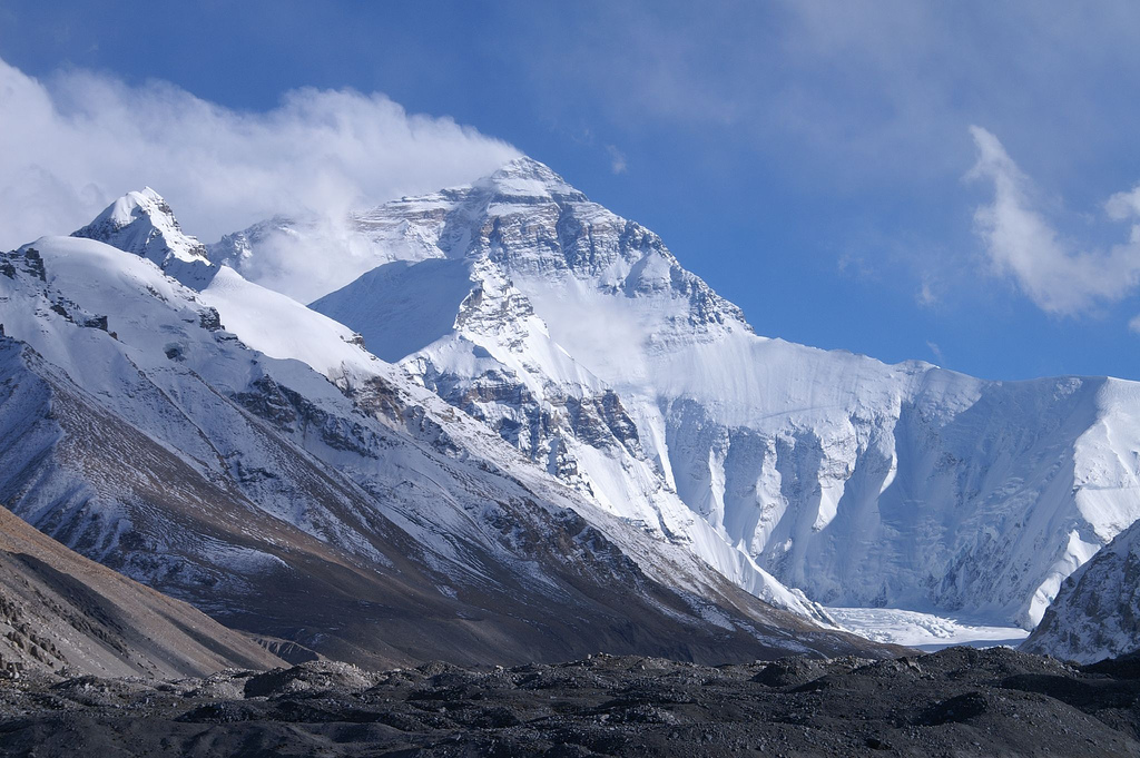
Hillary would go on to lead a life of high adventure. He continued climbing in the Himalaya of course and he also visited the South Pole as part of the Commonwealth Trans-Antarctic Expedition in 1958. He even led an expedition by jet boat up the Ganges River in 1977, going in search of its source.
Back home in New Zealand, he was a national hero, having been knighted by the Queen for his efforts. He even adorning the $5 bill there, an honor reserved for very few. But he also felt a strong kinship to the people of Nepal and he spent a lot of time in that country over the years. His generous charity work has left a lasting legacy with the people of that country, helping to build hospitals and schools with the help of his Himalayan Trust.
Sir Edmund Hillary passed away on January 11, 2008.
Norgay also continued climbing after finding success on Everest. He became the first Director of Field Training at the Himalayan Mountaineering Institute and continued to lead expeditions throughout the region. He was the Sirdar, or lead guide, of the first tourist expedition to Bhutan when that country first began opening to the public in 1975. He too remains a legendary mountain figure in his home country, where the airfield in Lukla, the starting point of the trek to Everest, has been renamed Tenzing-Hillary Airport in honor of the two men.
If you're an Everest fan, take a little time today to reflect on the achievements of Hillary and Norgay. The two men that showed the rest of us the way and did so with class and honor.
New Long Distance Trail To Open In South Sudan And Uganda

The Sir Samuel and Lady Florence Baker Historical Trail will stretch from Juba in South Sudan to Baker's View, which overlooks Lake Albert in western Uganda. The route will cover approximately 575 km (357 miles) along the same path that the Bakers followed on their two expeditions to Africa, which took place in the 1860's and 70's. The route will end at the point where Sir Samuel became the first European to ever set eyes on Lake Albert, which he himself named after Prince Albert.
The trail is being created through the efforts of anthropologist and explorer Julian Monroe Fisher who is working closely with the Uganda Ministry of Tourism, Wildlife & Antiquities, The Uganda Wildlife Authority and the Ministry of Wildlife, Conservation & Tourism for South Sudan. The descendants of Sir Samual and Lady Florence Baker are also taking part in the creation of this new route, which is being developed with the support of RailRiders Adventure Clothing and Costa Del Mar Sunglasses, both of which are sponsors of Fisher's Great African Expedition. It was during Phase Two of that expedition that he discovered the exact location of Baker's View and is credited by the Ugandan Government with correcting key locations on maps. Fisher will return to Uganda in June to begin placing historical markers along the trail which will designate places that the Bakers camped while they were exploring the region.

The new trail is set to officially open in January of 2014 in commemoration of the 150th anniversary of Baker's expedition. Unlike many trails of this kind, access will not only be granted to hikers, but also mountain bikers and eventually 4x4 vehicles as well. Future extensions to the trail will expand on its length, including a long loop in South Sudan that will lead to the summit of Mount Kinyeti, the tallest peak in the region at 3187 meters (10,456 ft).
The trail is also being seen as an economic boon for both Uganda and South Sudan. The hope is that the scenic route will lure trekkers to the area bring much needed in flux of tourism dollars.
Harrowing Tales Of The First Descent Of The Baro River In Ethiopia

In a recent post to his website, Richard shares some harrowing tales of his adventures along the Baro, which runs for approximately 306 km (190 miles) before it feeds into the Sobat River and eventually the White Nile. His stories include encounters with man-eating crocodiles, incredible white water and unexpected tumbles over waterfalls. The title of the article is "What's Worse? Death by Drowning or Crocodile" which pretty much tells you everything you need to know about this expedition. The article is a reminder of just how wild and untamed parts of our planet remain and how dangerous these expeditions can be. Definitely an excellent read for a variety of reason, as it touches on why we pursue dangerous adventures in the first place.
The video below serves as a bit of teaser for the story, but be warned, the footage is not for the faint of heart. There are some graphic images shown that some could find disturbing. If you'd rather avoid those images as best you can, I'd suggesting simply reading the article instead, although it also has a photo or two that aren't for the squeamish.
Video: Americans On Everest - 50 Years Later
Yesterday was the 50th anniversary of the first summit of Everest by an American, something I wrote about at length this morning on Gadling. To celebrate this event, National Geographic has released an amazing video that features some of the members of that expedition, as well as other prominent American climbers who followed them. The short film is a conversation about the mountain and features the likes of Jim Whittaker, Tom Hornbein, Conrad Anker and others. This one will definitely be popular with Everest purists and historians. Excellent stuff to for an important occasion.
Everest 50-NGA-VIMEO MASTER from National Geographic Magazine on Vimeo.
Video: Americans On Everest
As I mentioned yesterday, 2013 is an important year on Everest. Not only does it mark the 60th anniversary of the first ascent by Edmund Hillary and Tenzing Norgay, but it also is the 50th anniversary of the first ascent by an American and the first ascent along the difficult West Ridge.
While surfing through YouTube I came across this great classic climbing film that chronicled that 1963 American expedition. The footage is classic in every sense of the word and I'm sure this short film will bring back memories of watching these kinds of National Geographic movies in our classrooms while growing up. This is a real hidden gem and definitely one that fans of Everest will not want to miss.
While surfing through YouTube I came across this great classic climbing film that chronicled that 1963 American expedition. The footage is classic in every sense of the word and I'm sure this short film will bring back memories of watching these kinds of National Geographic movies in our classrooms while growing up. This is a real hidden gem and definitely one that fans of Everest will not want to miss.
Robert Falcon Scott's Final Letter Revealed
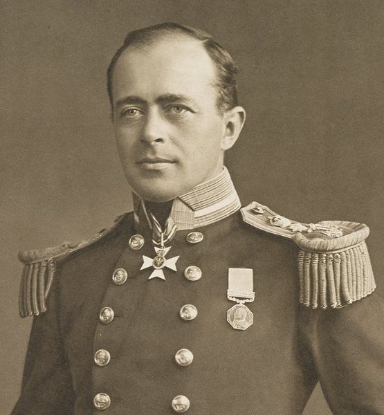
We know that Scott was the last of his men to die and before he perished he wrote a few letters to friends and family back home. One of those letters was to Sir Francis Bridgeman, one of his former commanding officers. Last week, the contents of that letter were revealed to the public for the first time. It read:
To Sir Francis Bridgeman
My Dear Sir Francis
I fear we have shipped up – a close shave. I am writing a few letters which I hope will be delivered some day. I want to thank you for the friendship you gave me of late years, and to tell you how extraordinarily pleasant I found it to serve under you. I want to tell you that I was not too old for this job. It was the younger men that went under first. Finally I want you to secure a competence for my widow and boy. I leave them very ill provided for, but feel that the country ought not to neglect them. After all we are setting a good example to our countrymen, if not by getting into a tight place, by facing it like men when we were there. We could have come through had we neglected the sick.
Good-bye and good-bye to dear Lady Bridgeman
Yours ever
R. Scott
Excuse writing – it is -40, and has been for nigh a monthOne of the things that had continued to endear Scott to his countrymen is that he continued to maintain his famous British stiff upper lip, even to the bitter end. That is seen once again in this letter as he asks for forgiveness for his poor penmanship due to the harsh weather. You would think when you know that you are facing your own impending doom you wouldn't worry so much about that, but Scott still cared about the details even as he knew death was coming for him.
Would we all have the strength and courage to face our mortality if placed in the same circumstances? I'd like to think so, but I'm not sure that would be the case. These glimpses into Scott's personality help to keep his legend and spirit alive more than a century after his death.
Video: Mt. Everest - The Quest
As we ramp up to the start of a new climbing season in the Himalaya, its fun to look back on a bygone era of mountaineering in Nepal. The video below is the first part of a documentary about the first expedition to climb the mountain and some of the old footage is great, including shots of Edmund Hillary and Tenzing Norgay. I also happen to love the over the top narration and bombastic music. It reminds me of the educational films we use to watch as a kid in school and I mean that in the best possible way. At 42 minutes in length, you'll once again have to make yourself comfortable, but if you enjoy this look back at climbing history, you may want to check out the second part of the documentary which can be found here.
Final Member Of Hillary-Norgay Everest Team Passes Away

By all accounts, Lowe was instrumental in putting Edmund Hillary and Tenzing Norgay on top of the mountain. He did much of the work shuttling gear up the South Col to help establish the high camps and broke trail for the two men who would eventually claim the lion's share of the glory. It was also Lowe who was first to go up the slopes of Everest to greet his life-long friend Hillary, and the Sherpa guide Norgay, while they were still descending from their historic climb.
A talented photographer, Lowe managed to capture many of the iconic images that helped chronicle the expedition that finally conquered Everest. Those skills earned him a spot on the first Trans-Antarctic Expedition, which crossed that continent for the first time in 1957-58.
A renowned ice climber, Lowe was a schoolteacher by trade although the remote places of the planet called to him more. As part of a New Zealand climbing team, he and some friends managed to climb six new peaks in the Himalaya in 1951 alone. Other expeditions took him to Greenland, Ethiopia and the Pamirs. Later in life he would serve as part of the U.K.'s Department of Education serving as an inspector of schools. He also helped fund the Sir Edmund Hillary Himalayan Trust in that country as well.
Lowe truly lived a life of exploration and adventure. His journeys took him to the far corner of the globe and into the history books. While it is sad to see him pass, 89 years of adventure is quite a lot for any single lifetime. I give George a tip of the cap for a life well lived.
Explorer Julian Monroe Fisher Completes Phase Two Of Great African Expedition
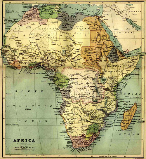
This phase of the expedition follows a successful launch of the project last spring during which Fisher traveled overland from Cairo, Egypt to Khartoum, Sudan. Traveling solo, the anthropologist began his study of the Ethnographical make-up of parts of Africa. The plan is to compare the modern day dispersal of local tribes with historical records from the 19th century with similar data.
During Phase Two, Fisher was joined by British photographer and documentarian Jon Maguire as he traveled north out of Juba into the realm of the Mundari tribes. From there, the two men turned southeast, traveling into the Eastern Equatoria region of South Sudan. Next, their route carried them across the border into northern Uganda, where they were joined by David Baker and his daughter Melanie. David is the great-great grandson of Sir Samuel Baker, and together the group trekked to the location where the famed explorers became the first European to set eyes on Lake Albert. Marking the exact GPS coordinates of that point, Fisher was later able to provide the Ugandan government with the precise location, something they intend to use to promote the spot to travelers.
Fisher and Maguire now intend to make a documentary of their travels through South Sudan, which remains the planet's newest nation. Few know much about the country and its troubled history, and it is possible the film will give many of us our first glimpse into life in that country.
Phase Three of the expedition will follow the Kagera River through Burundi, Rwanda and Tanzania before making a circumnavigation around Lake Victoria. The start of that phase of the expedition has yet to be announced.
Everest 2013: The Never Ending Search For Mallory and Irvine's Camera
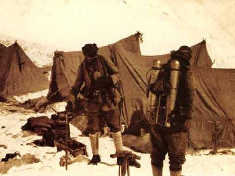
The reason why this camera is seen as being an important artifact in terms of climbing history is that it may definitely prove once and for all whether or not Mallory and Irvine actually managed to summit before their disappearance on the mountain. If so, it would mean that they managed to top out nearly 30 years earlier than Edmund Hillary and Tenzing Norgay, who didn't make the first successful summit until 1953.
Mallory and Irvine were last seen heading up the North Side of Everest and were reportedly about 800 feet (243 meters) below the summit. What happened after that remains anyones guess, but there are some who believe the duo reached the summit but died on their descent. And since they carried a Kodak camera with them it is believed that if they did summit, they would have taken pictures while at the top. When Mallory's body was discovered back in 1999, the camera was not with the rest of his gear. That would be consistent with the belief that Irvine was carrying the camera at the time and since his body remains undiscovered, the world waits to see what the camera may reveal.
Which leads us back to Alan's interview with Tom Holzel, who believes that he may know where Irvine's body is located. Holzel has reviewed high resolution images of the mountain and has spotted an "oblong blob" that he thinks could be the fallen climber. He further believes that the camera will still be on the body and that it will be intact, possibly showing exactly what happened that fateful day nearly 90 years ago.
In the interview, Holzel talks about his efforts to raise $10,000 to pay for a flyover of the mountain to get improved images to help aid his search. If those photos help solidify his case, he then hopes to send a small team of climbers up to investigate the "blob" in the images to see exactly what it is.
It should be noted that Holzel has been beating this drum for a couple of years now but hasn't had a lot of success in finding sponsors or raising funds. It doesn't appear that he has anything in the works for this year either, which means the mystery will probably continue to remain unsolved, at least for now. But hey, it wouldn't be a new Everest season if we didn't hear about the camera at least once!
Subscribe to:
Posts (Atom)


Follow Us
Were this world an endless plain, and by sailing eastward we could for ever reach new distances